Hunting Bayou
Retreat and rebuilding in Northshore, Houston, after Hurricane Harvey
Hurricane Harvey flooded the neighborhoods along Hunting Bayou almost to their rooftops in 2017, much as Tropical Storm Allison had in 2001. Houston's clay soil drains poorly, and decades of groundwater and oil extraction have let the ground near the Ship Channel sink by as much as ten feet.
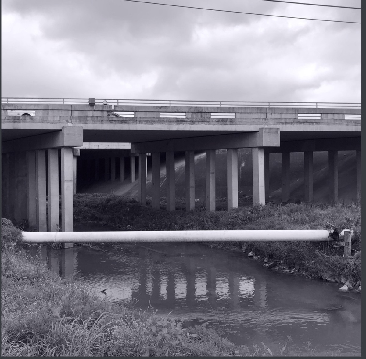
The studio asked how a low-density city could shrink its footprint in the floodplain. Our part of the bayou was downstream, where it crosses the I-10 freeway in Northshore. The proposal gives the wettest land back to the bayou and a larger park, and rebuilds the housing and shops it displaces, denser, beside the freeway, in phases through 2050.
Northshore
Northshore is a super neighborhood of about nine square miles, just north of the Houston Ship Channel. About three quarters of its residents are Hispanic. It holds Herman Brown Park, around 500 acres and the largest open space on Hunting Bayou.
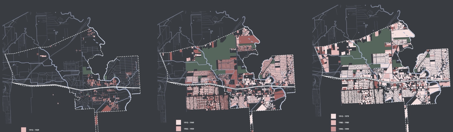
The first development, from the 1910s to the 1940s, was industry along the Ship Channel. Most of the houses came between the 1950s and the late 1970s. After 1980, building nearly stopped.
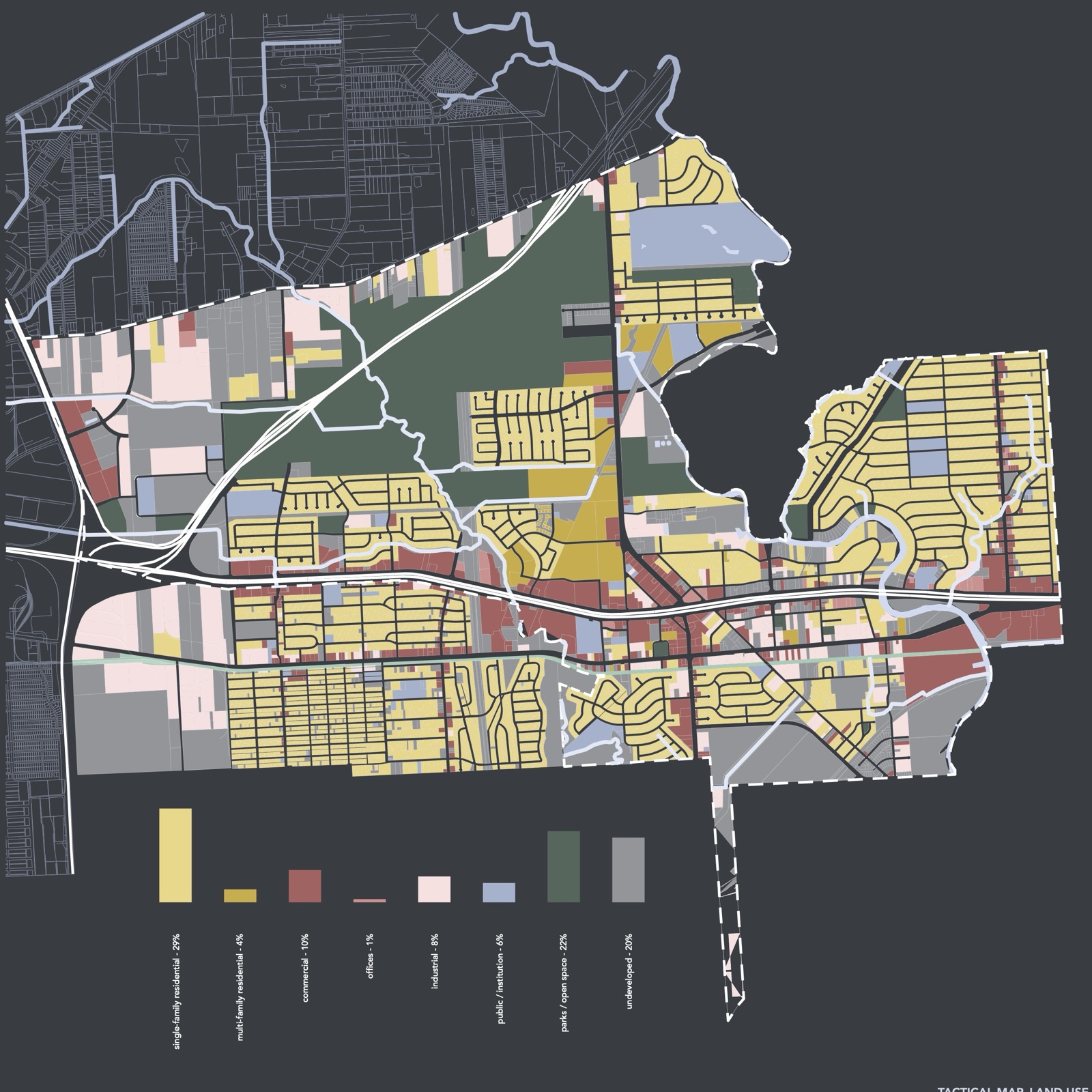
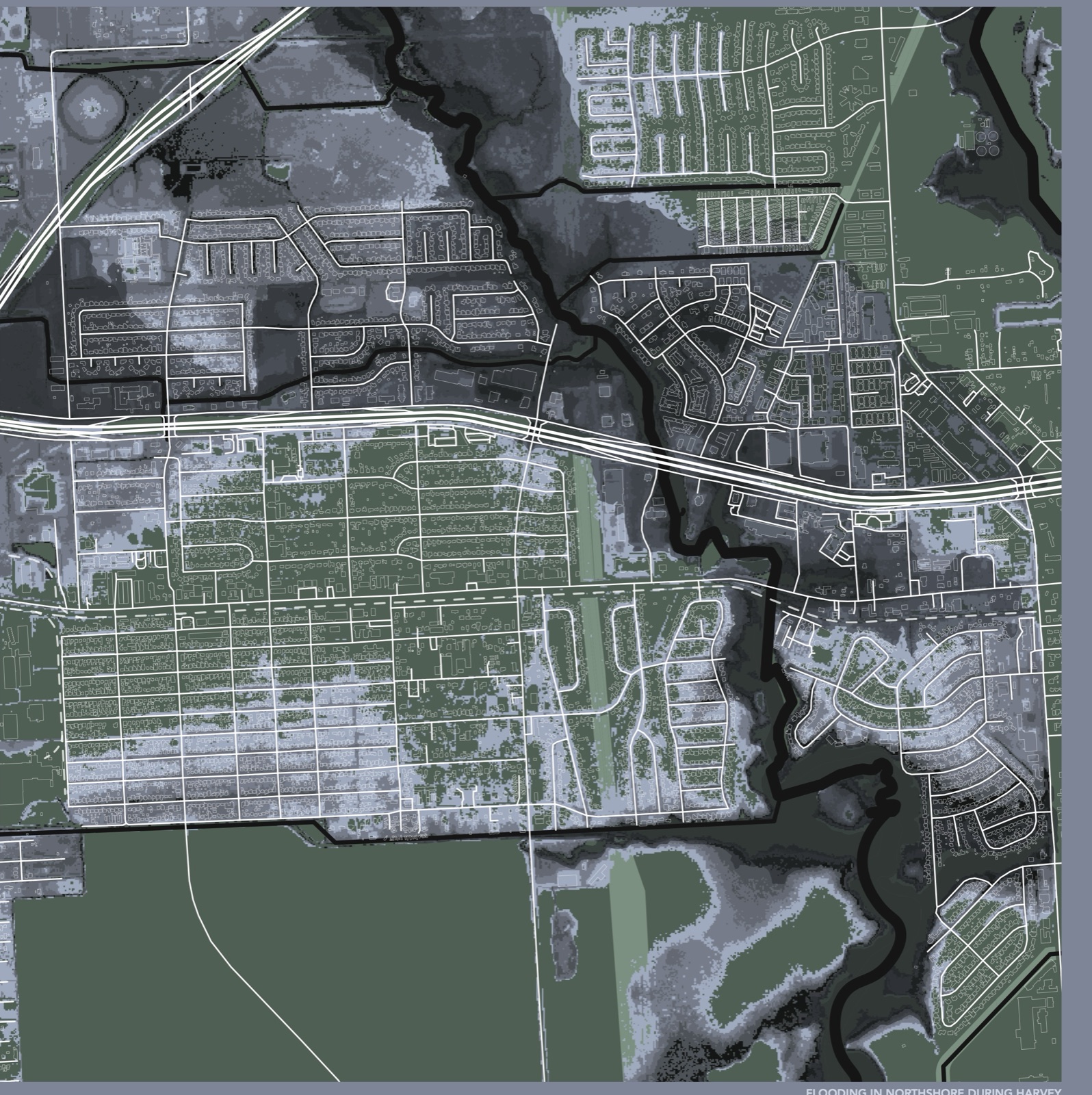
Left, land use today: mostly single-family houses, with shops along the freeway and industry toward the channel. Right, flooding during Harvey. The worst of it was north of I-10 around Herman Brown Park, where water can't drain fast enough. Buyouts of repeatedly flooded homes had already begun, about $11.7 million of them, and we found empty storefronts along the freeway.
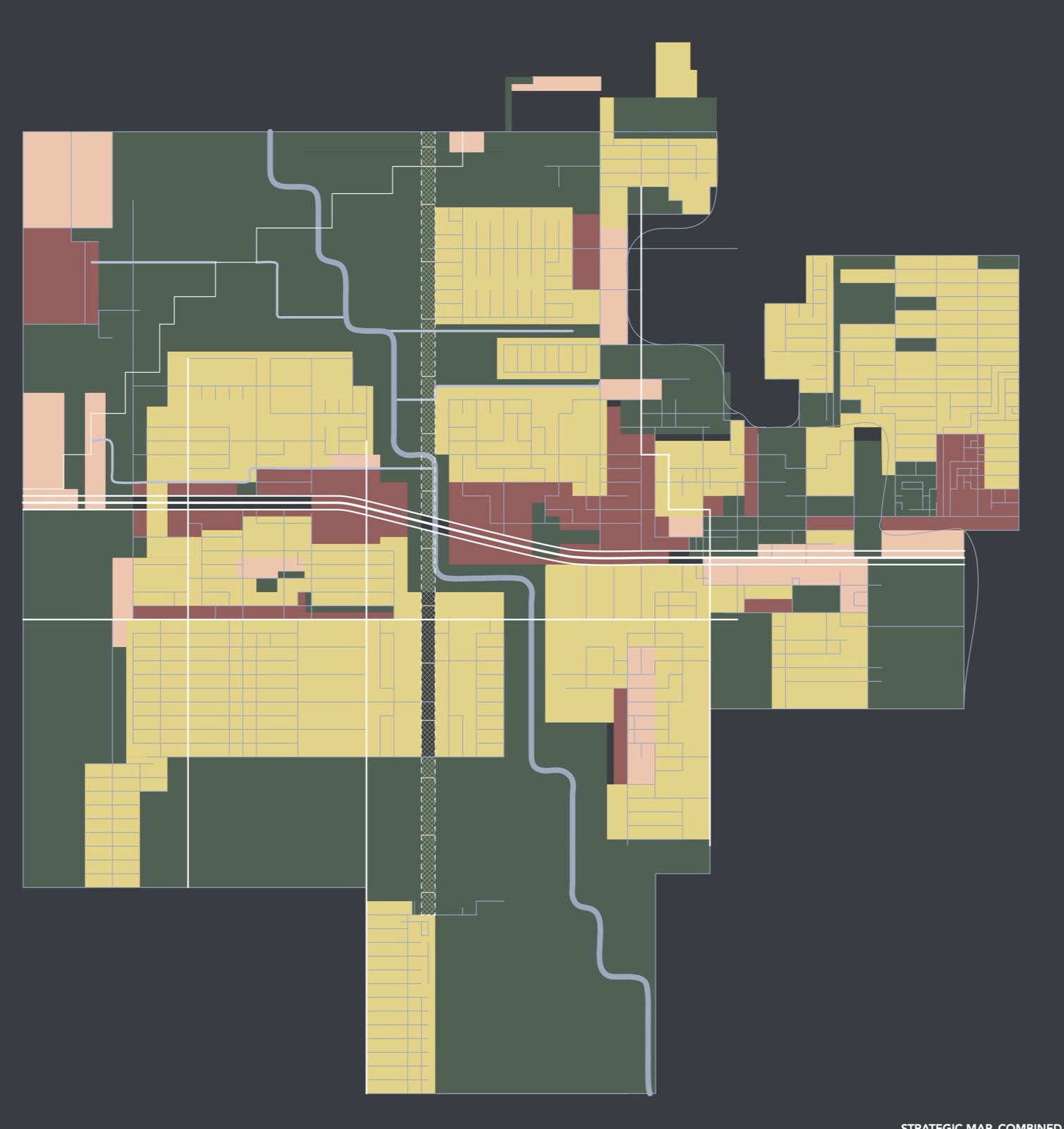
A strategic map layering housing, commerce, industry and green space picked out the site: the crossing of the bayou and the freeway.
The pinwheel
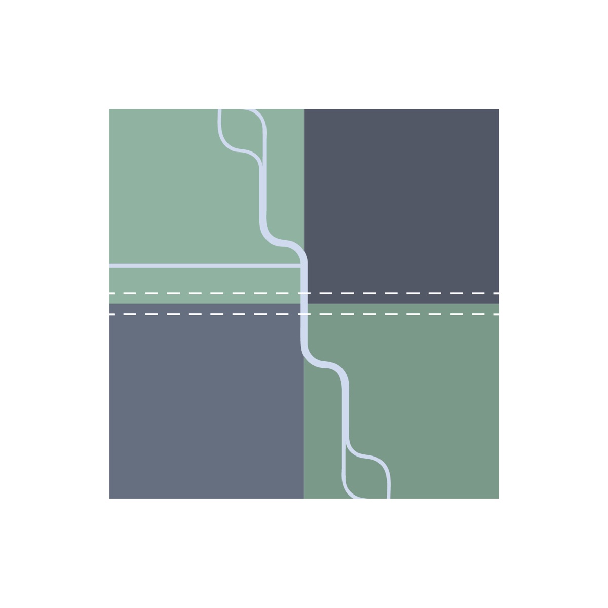
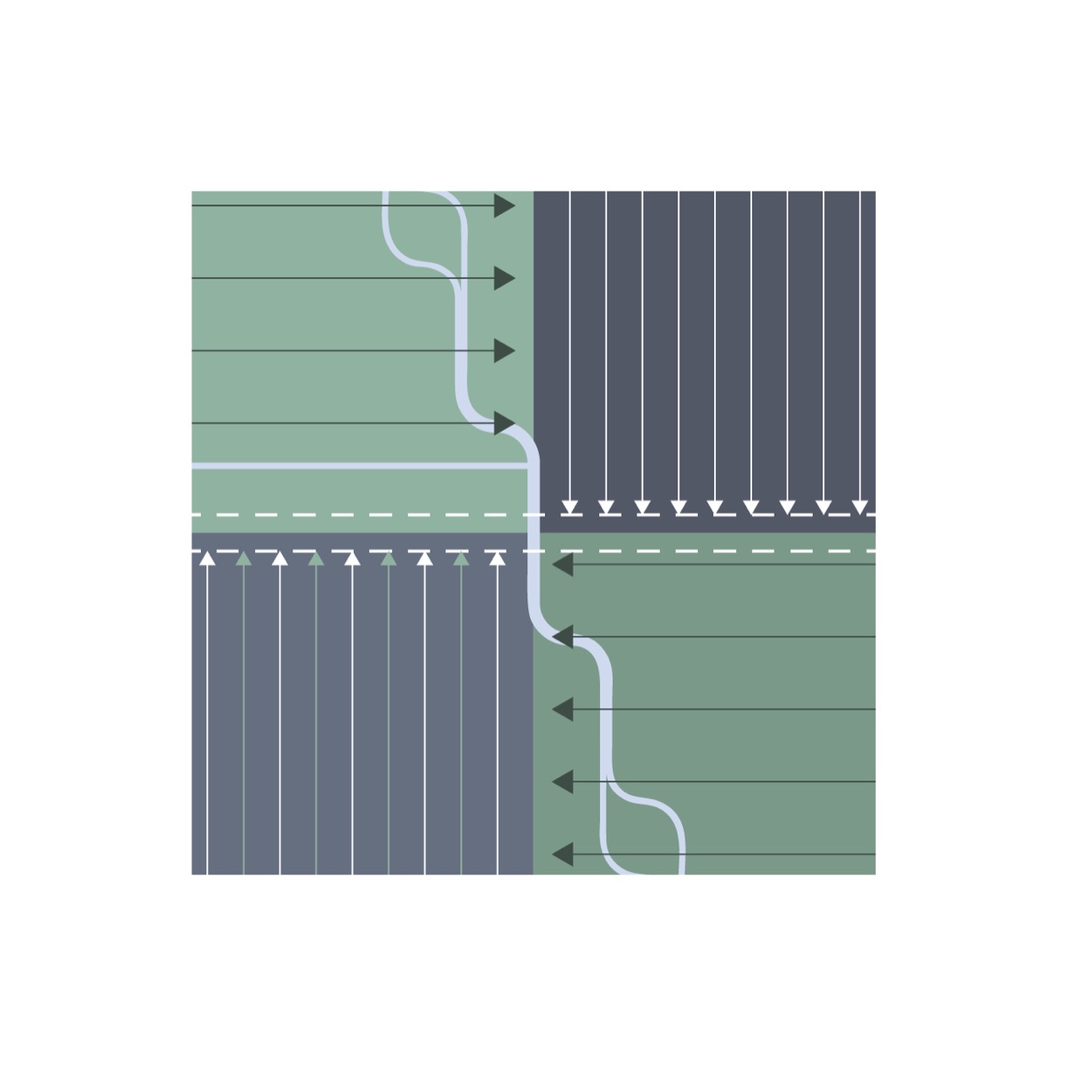
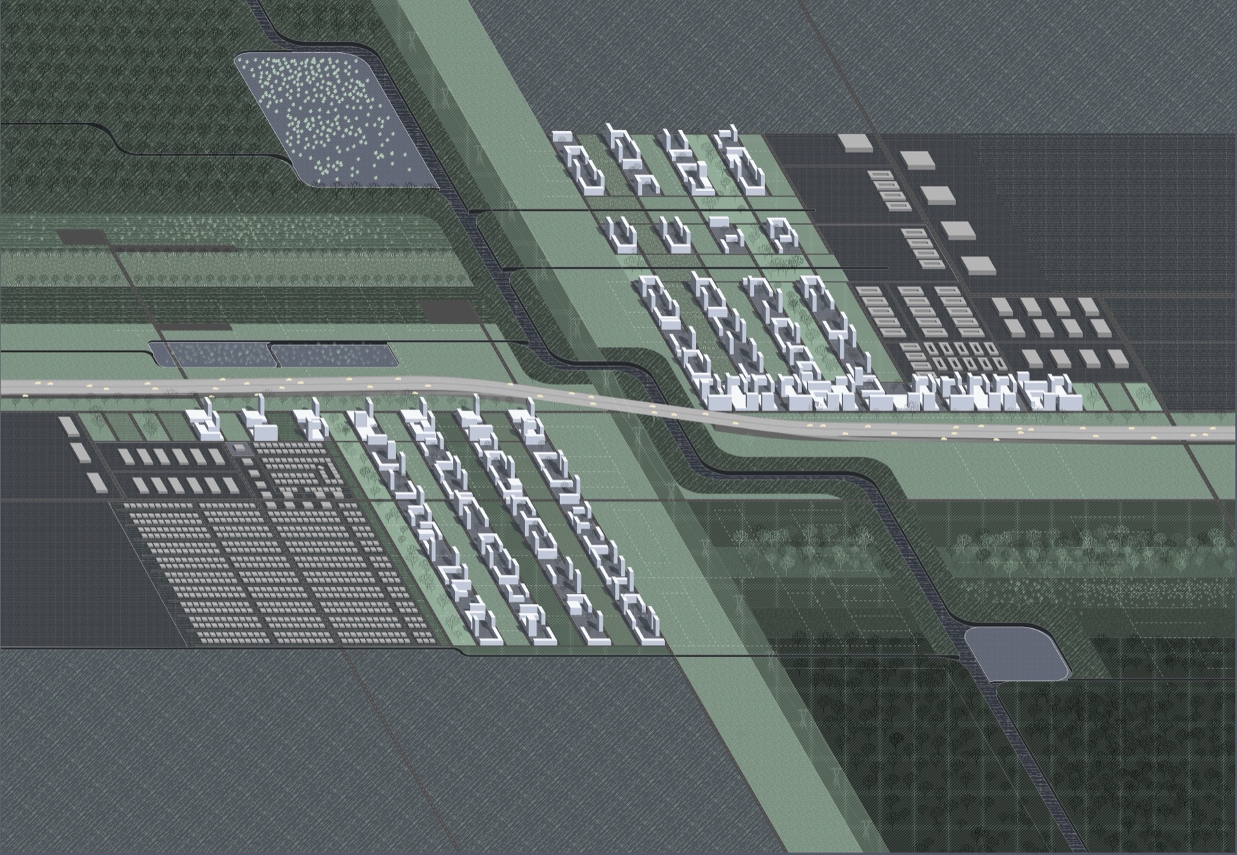
The freeway and a power-line corridor through the park split the site into four quadrants, each given its own character: (A) park and recreation, (B) a dense urban zone, (C) a lower-density suburban zone, and (D) nature restoration.
The plan is a pinwheel. In the two built quadrants, the grain runs along the freeway; in the two green ones, it runs along the bayou. The park quadrant, where the flooding is worst, is cleared first, and detention ponds in the green quadrants hold back storm water.
Phasing, 2025 to 2050
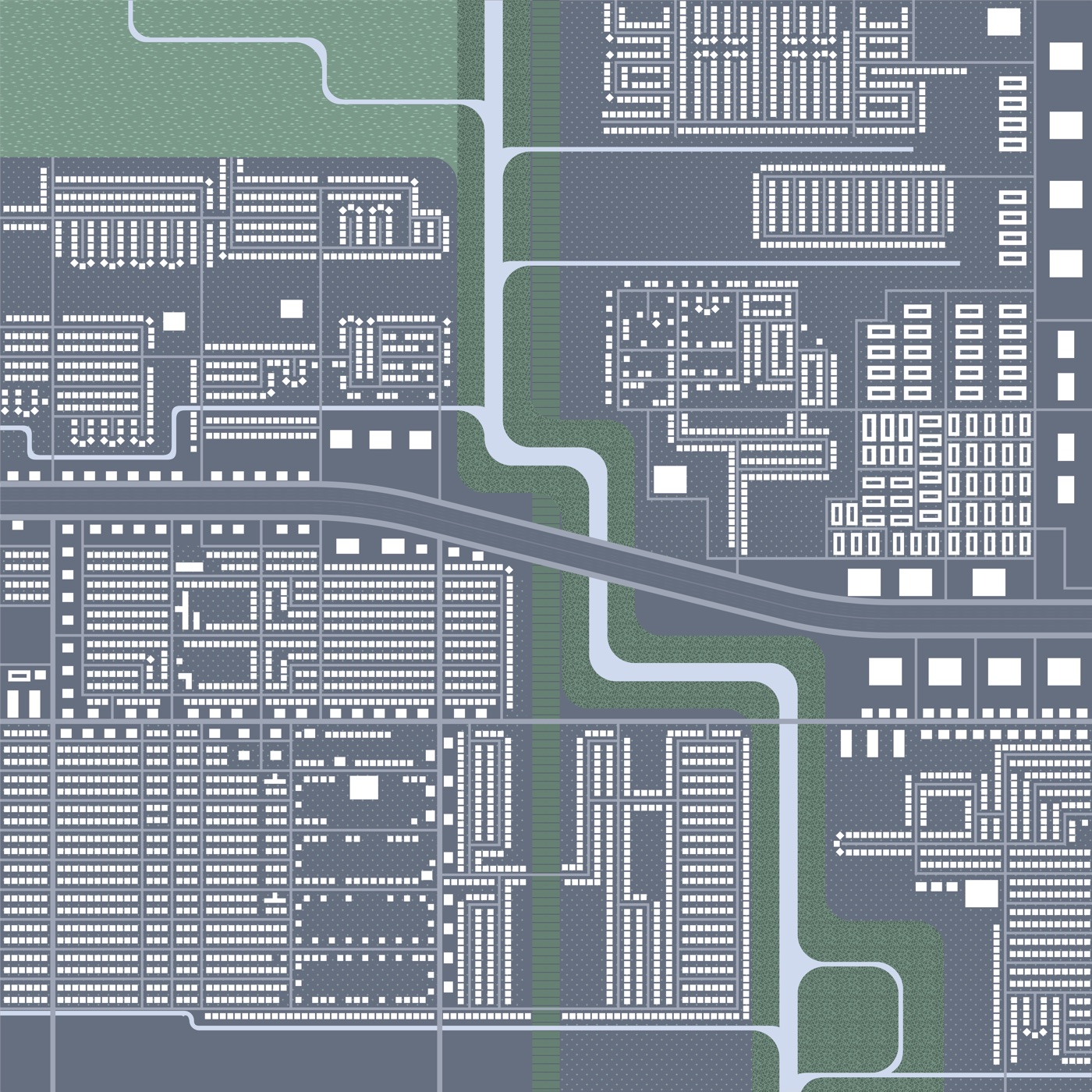
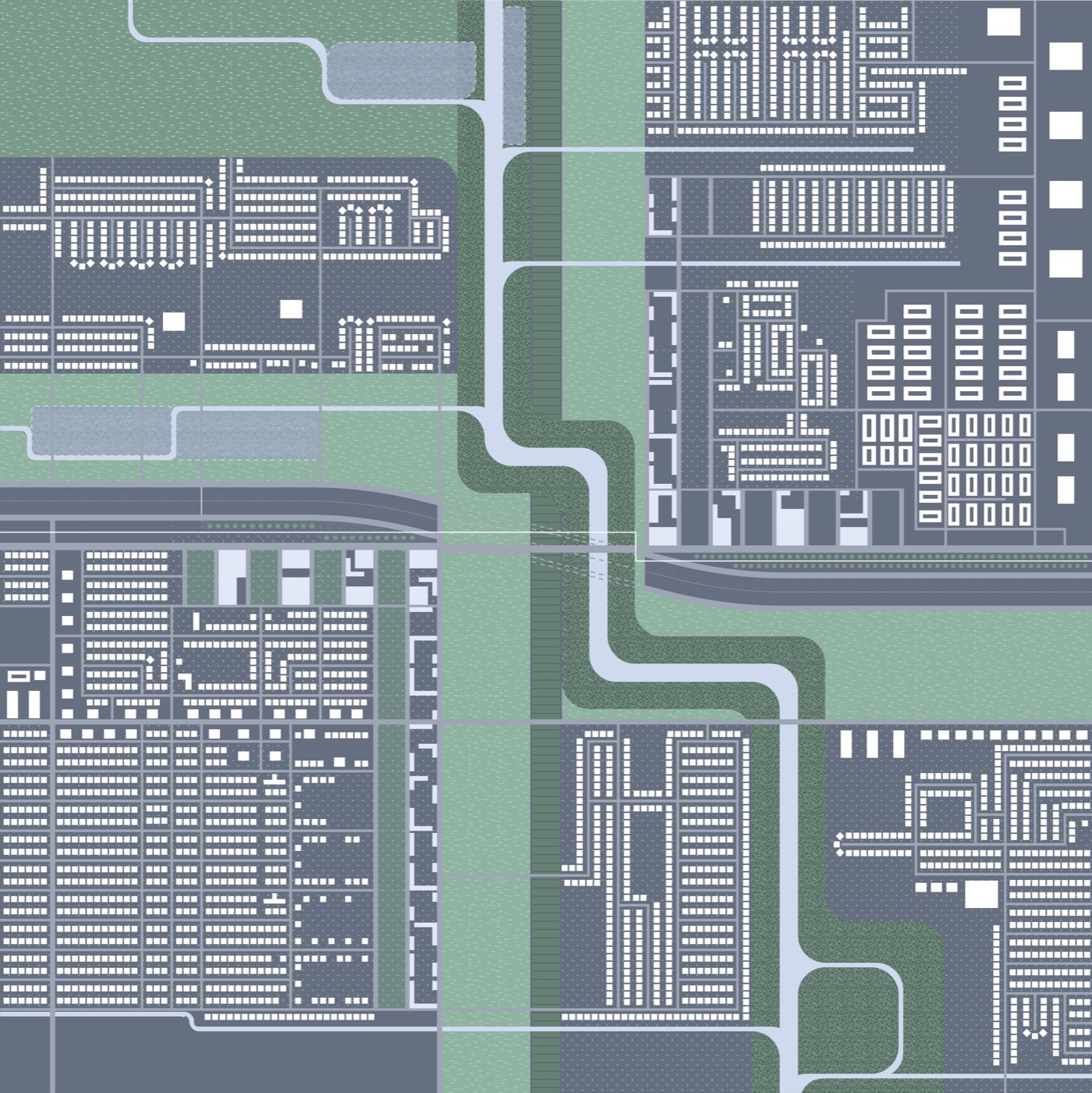
Today and 2025. The southwest quadrant floods least, so new building starts there, while the quadrant to the north is cleared for an expanded Herman Brown Park. The green band along the bayou widens, a band of landscape is set along the freeway, and new homes and shops go up to rehouse people from the areas being cleared.
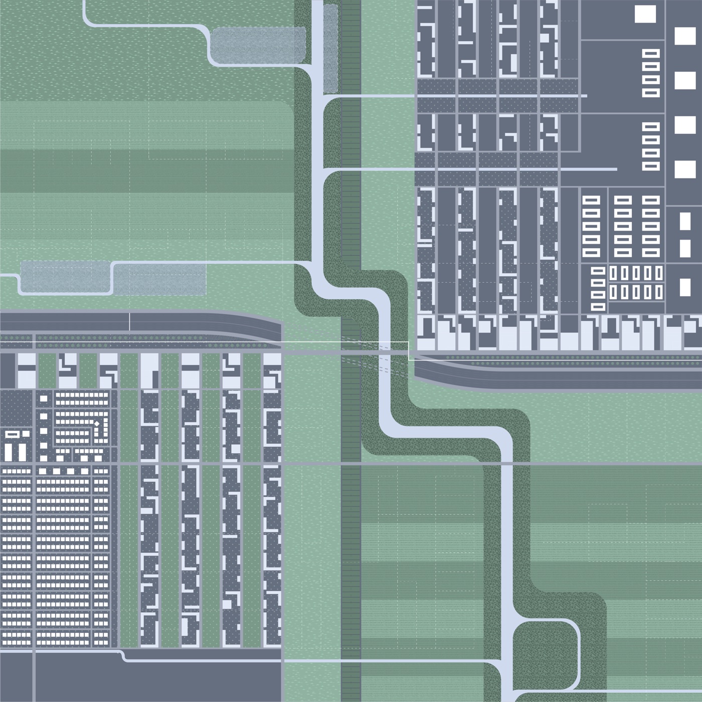
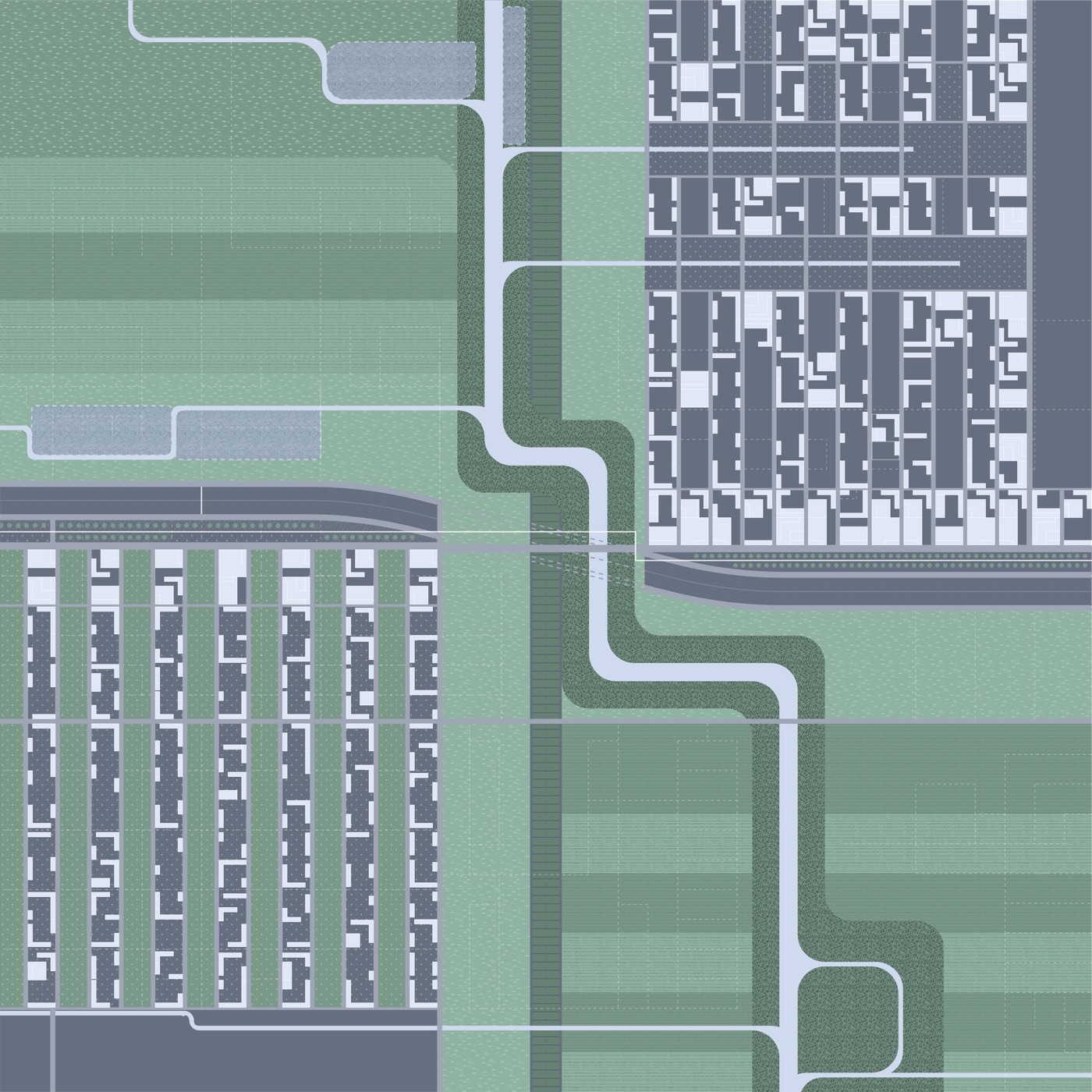
2035 and 2045. The swap continues block by block. By the third phase the existing houses on the site are all gone, and the landscape along the bayou and freeway is complete.
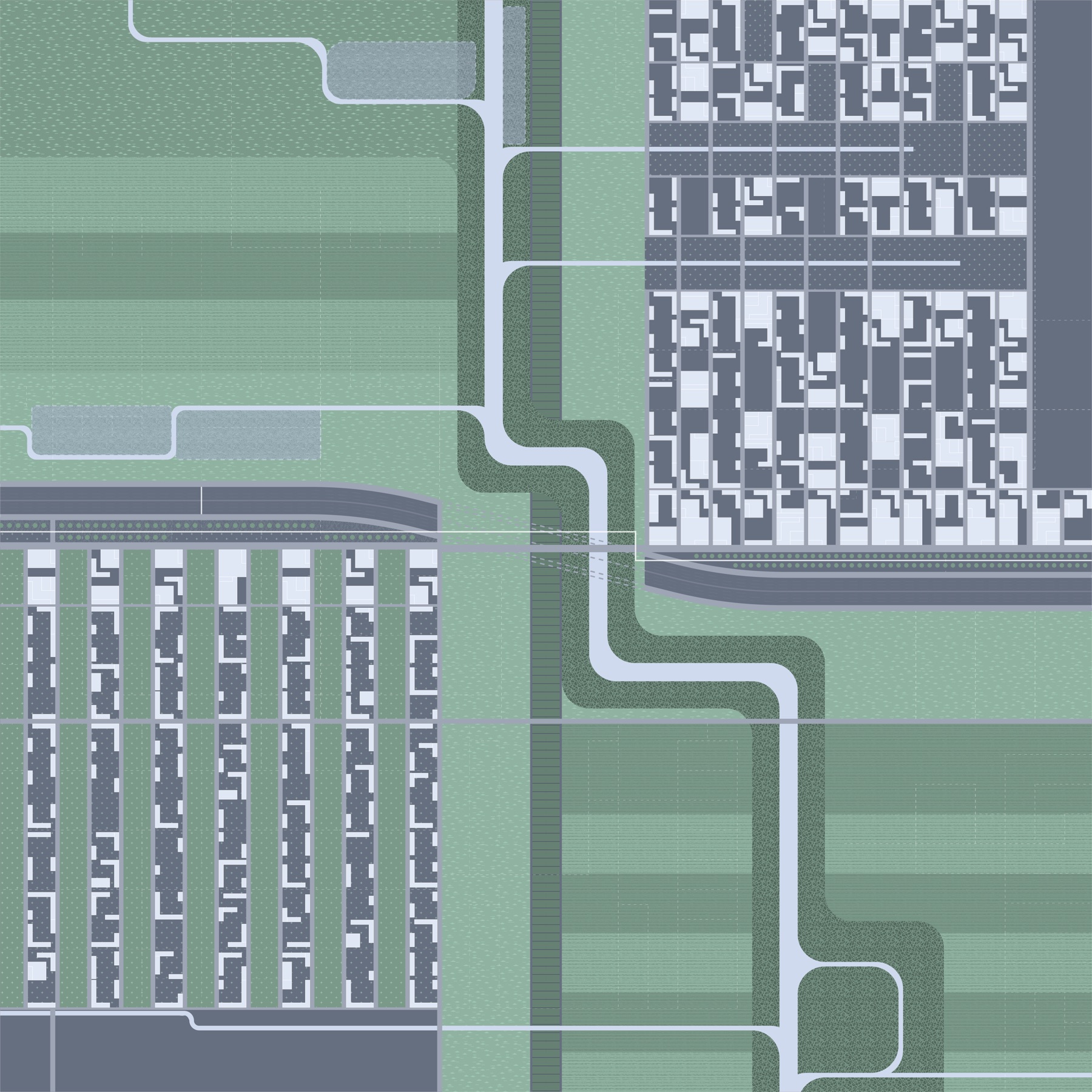
2050. The finished pinwheel: dense strips of building along the freeway, and park and restored bayou where the houses used to flood.
Building blocks
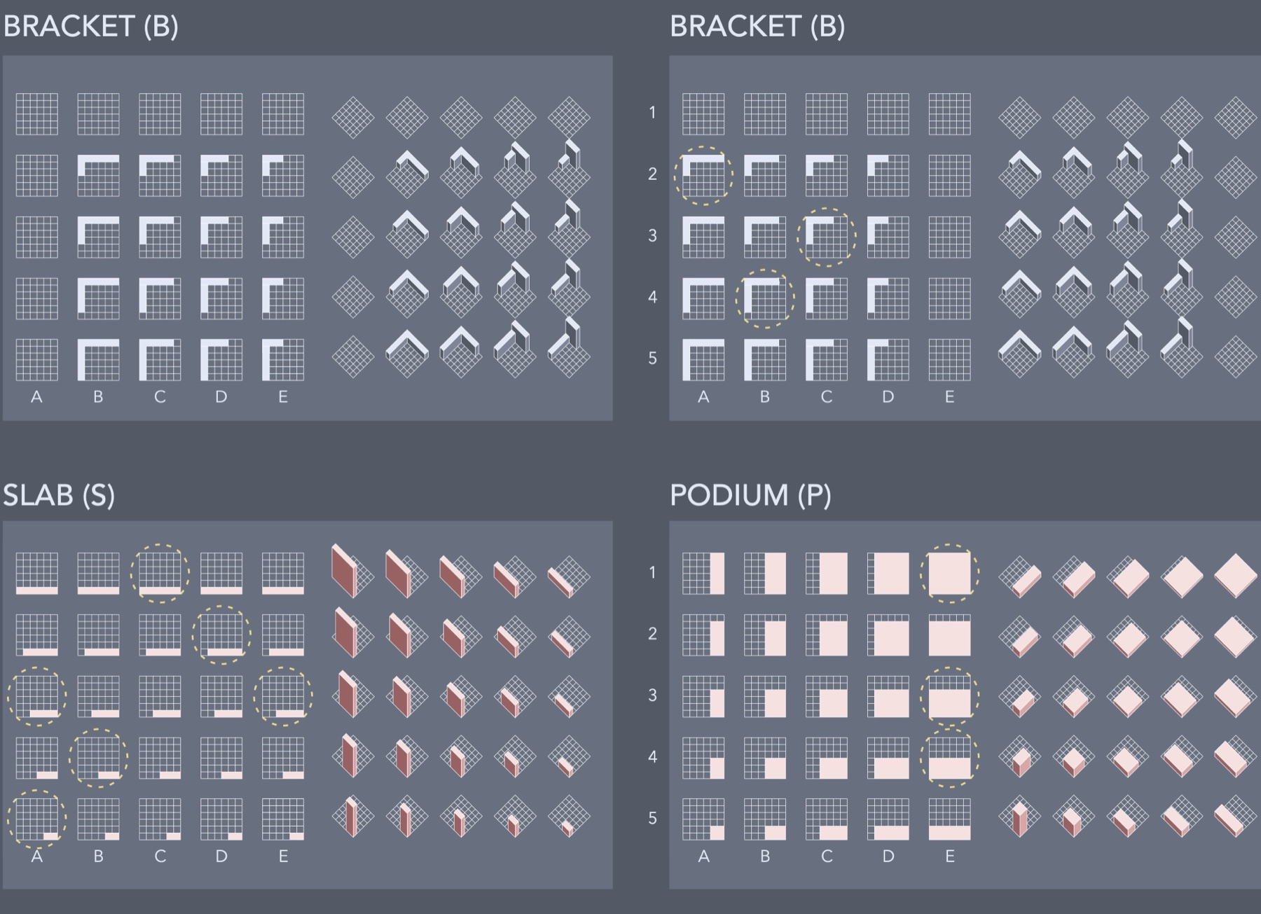
The buildings come out of a search space: a matrix of variations on three shapes (a bracket, a slab and a podium) and their combinations, drawn at the scale of one block. Promising pieces were circled and carried forward.
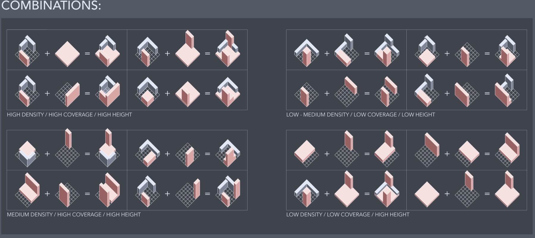
Pieces were then paired and sorted by density, lot coverage and height, from low and spread out to tall and packed.
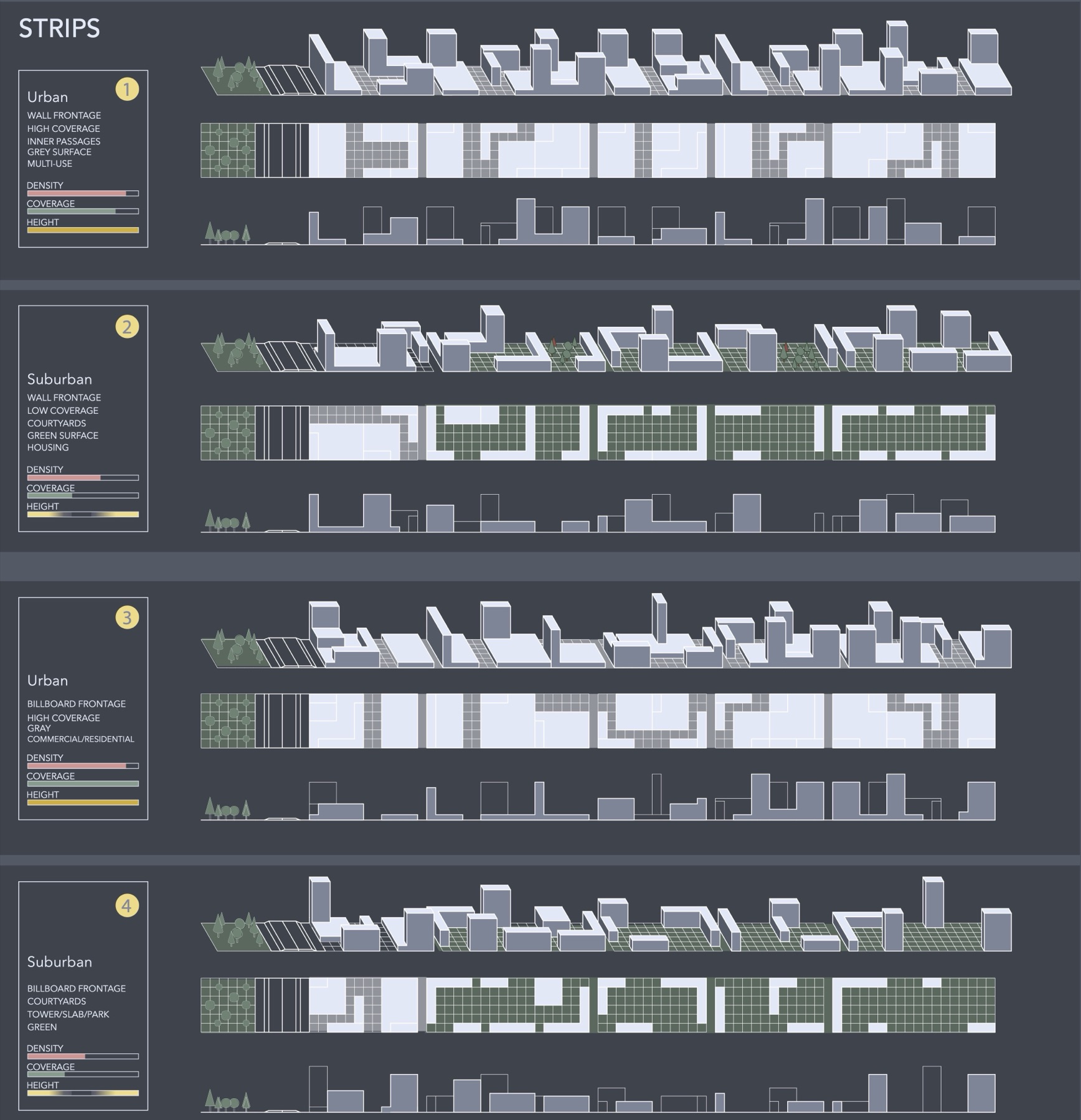
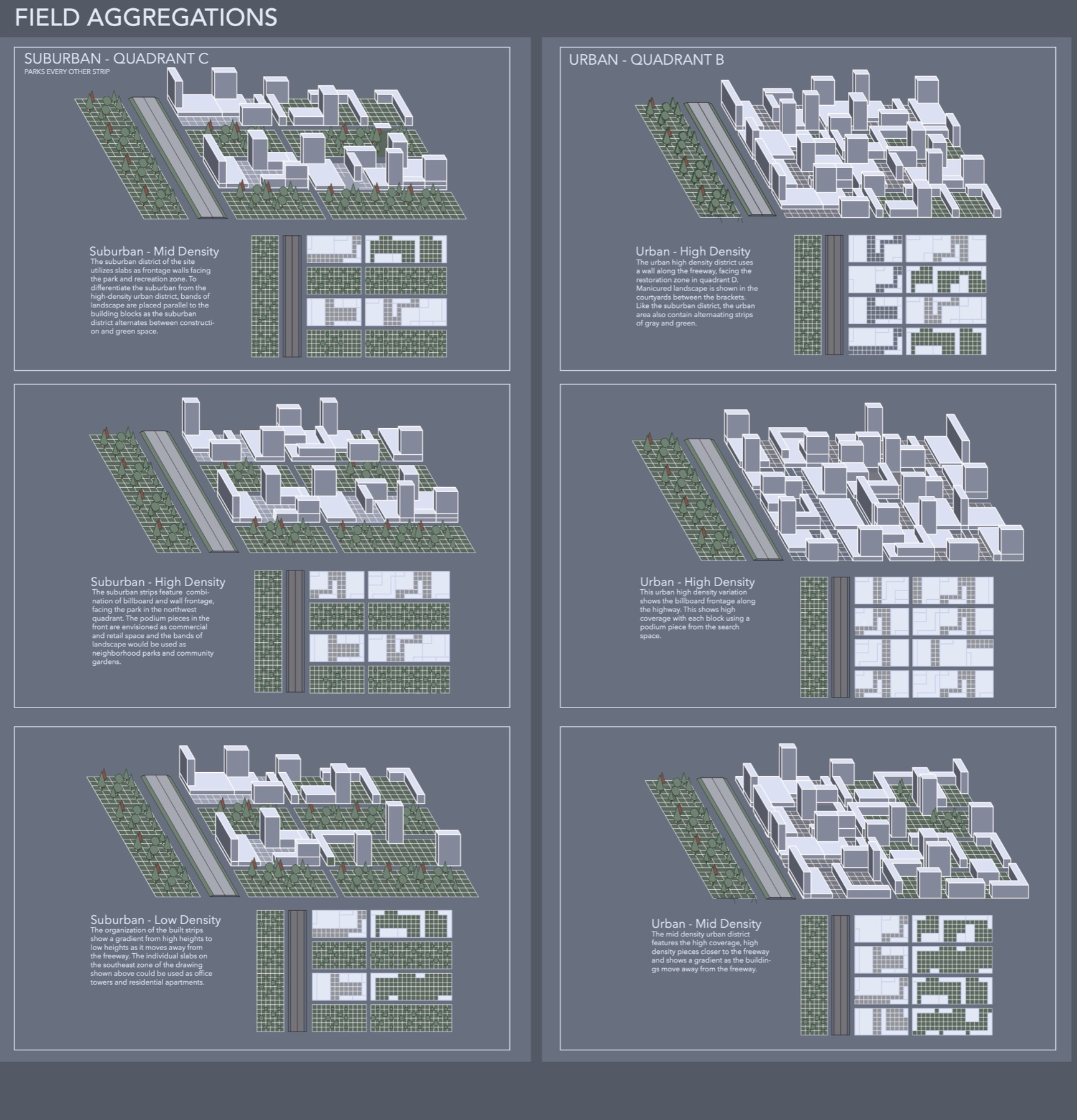
Paired blocks line up into strips, which set the two built quadrants apart. The urban quadrant presents a wall or a row of billboard-like slabs to the freeway, with gray surfaces and courtyards behind. The suburban quadrant alternates built strips with bands of landscape for parks and community gardens, stepping down in height away from the freeway.
2050
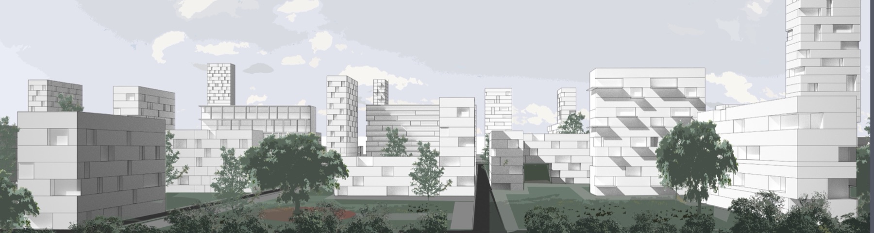
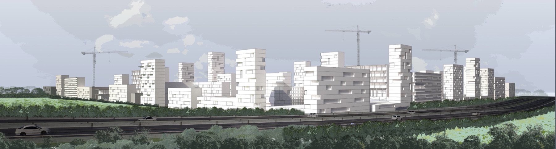
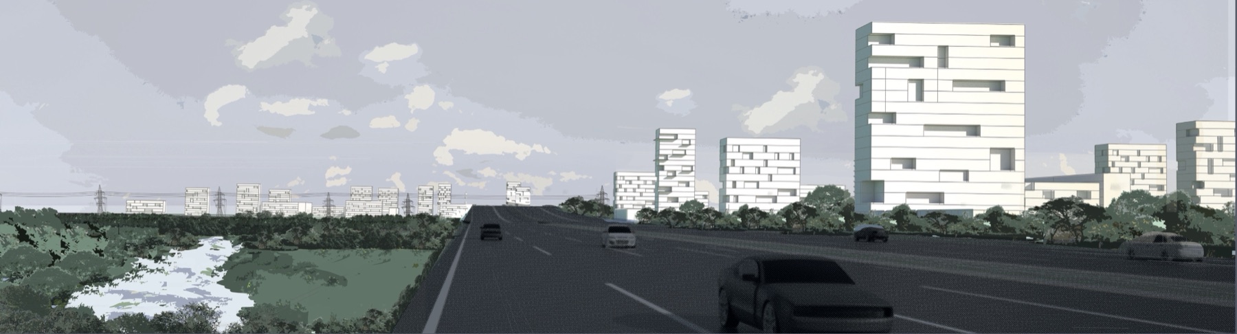
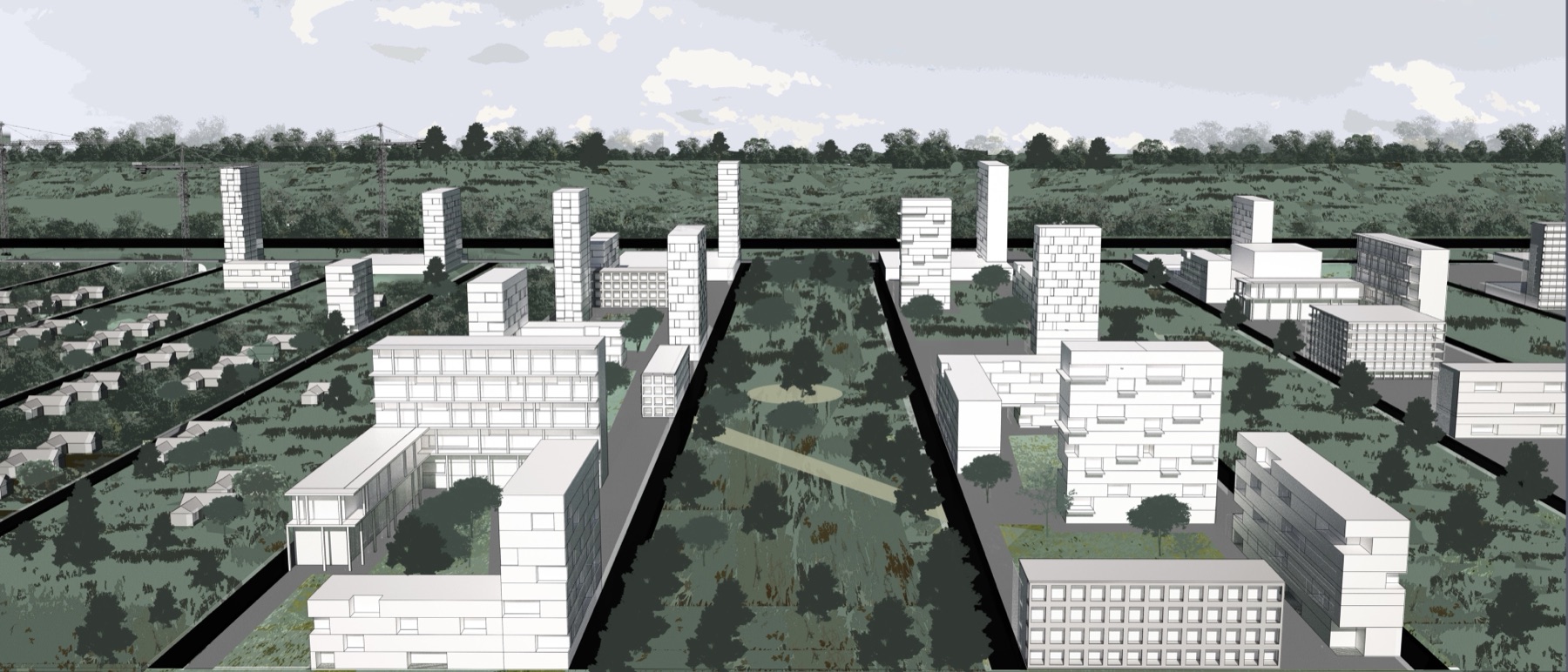
From the freeway, the new neighborhood reads as a skyline, still under construction; beside the road, the bayou has room to flood.