Risk Urbanism
Transit City: a direction for the dreamscape
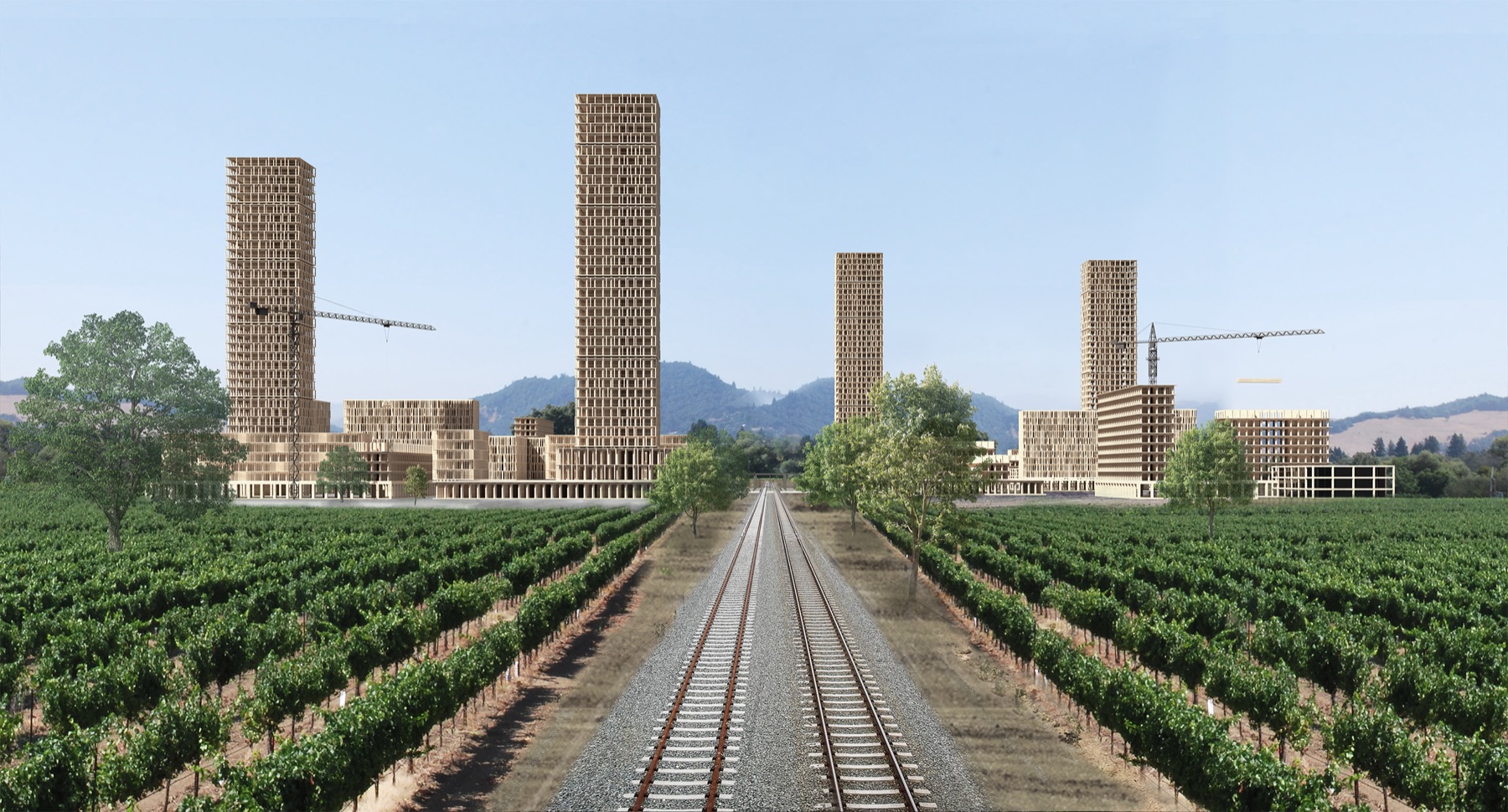
The atmosphere is getting drier, and it is driving wildfires California has never seen before. The crisis has only begun, and its outcome will largely be decided by how we choose to see it. Managing a crisis is a process of transformation: when one system stops working, a new, more adaptable one emerges.
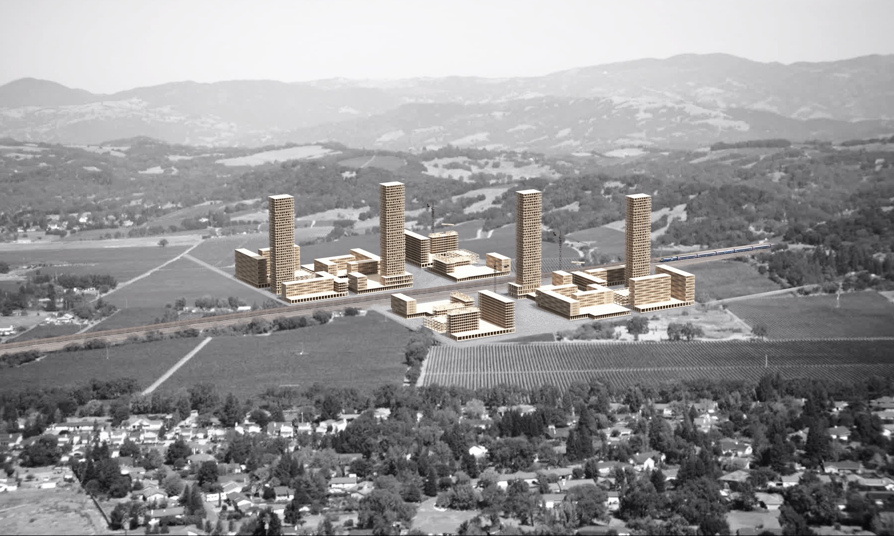
Transit City is a glimpse of that new system: a residential settlement for a new political era. It starts from the need to clear the wildland-urban interface, where homes sit in high fire-risk zones, and treats the displaced homes as the starting point for denser living. It is sited on a future high-speed rail line, as a prototype for transit-oriented development in California.
We can't live here anymore
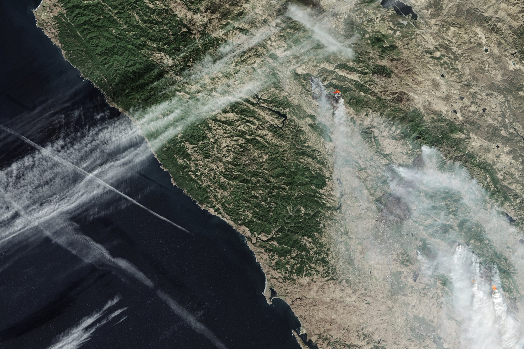
An old story about California has come back into fashion: that its original sin was building a civilization on land that burns, shakes and slides, and that one day the land will teach us a lesson. The moral is that we never should have lived here. But we do, and we will keep doing so, so the question shifts from whether to live here to how.
For all its progressive politics, California builds by reactionary urbanism. Between 1940 and 2000 the state added nearly 10 million homes, 80% of them outside urban areas. If nothing changes, low-density land use will grow by 60% by 2050, displacing about 12 million acres of wildland and working landscape. By 2000, 15% of California's homes already sat in high fire-risk areas of the wildland-urban interface.
Wildfire is a natural, necessary part of a healthy ecosystem, but it is disastrous for the communities built into it. Over the past 40 years California's annual burned area has grown fivefold, driven by rising atmospheric aridity. The Tubbs Fire (2017) and the Camp Fire (2018) became the most destructive in the state's history, and climate models project that the aridity gained since the 1800s will double again by 2060.
Research: growth, fire, earthquakes
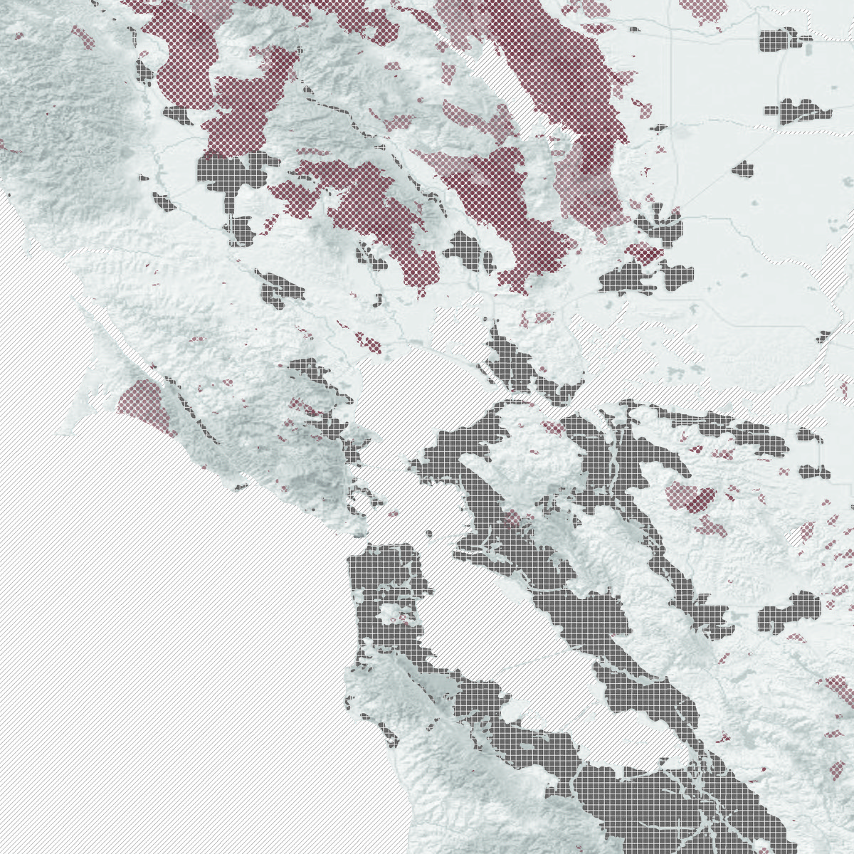
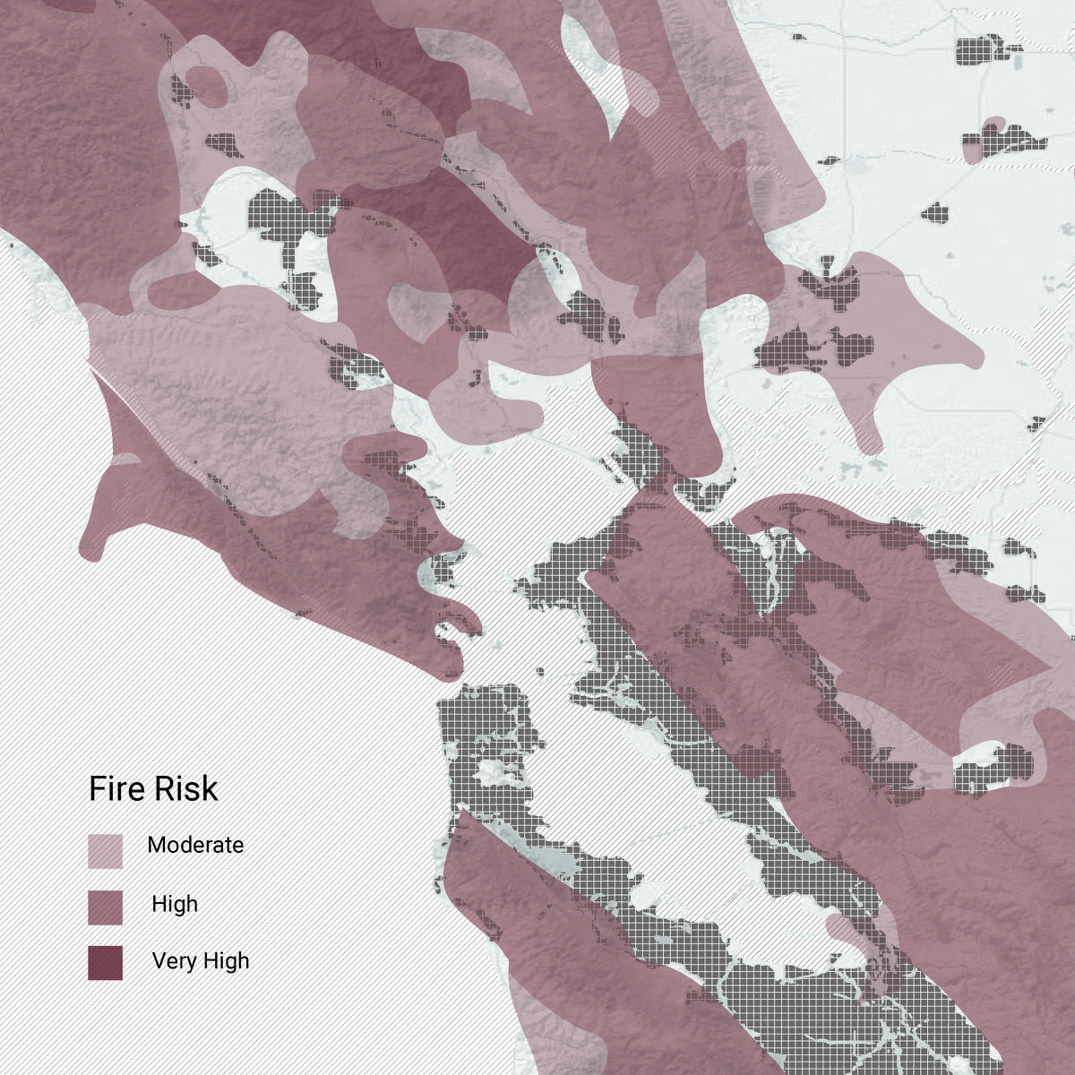
Wildfires. Left, the footprints of past fires, 1970–2019; right, CAL FIRE's risk zones. The wildland-urban interface is where buildings are most vulnerable and where people most often start fires. Seventy years of suppression have built up fuel and made severe fires more likely, while homeowners, trusting the state to put fires out, rarely clear enough fuel themselves.
In 2017 the Tubbs Fire swept through northern Santa Rosa, a city of 175,000 fifty miles north of San Francisco, destroying more than 5,000 structures. In 2019 the Kincade Fire ignited a few miles north of the Tubbs footprint and forced the largest evacuation in Sonoma County's history, while utility power shutoffs cut electricity to more than a million customers across Northern California.
The business-as-usual recovery is to rebuild in place with better materials and stricter landscaping rules. Three fire seasons have shown how little those measures can do. Faced with ever more volatile conditions, the economical solution is the most risk-averse one: remove the catalysts from the high-severity zones. In other words, the people who live there.
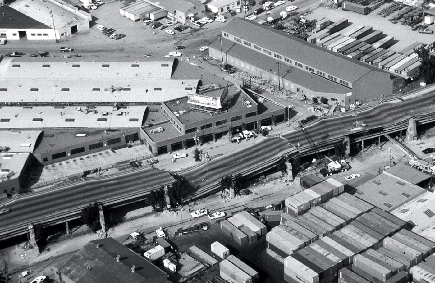
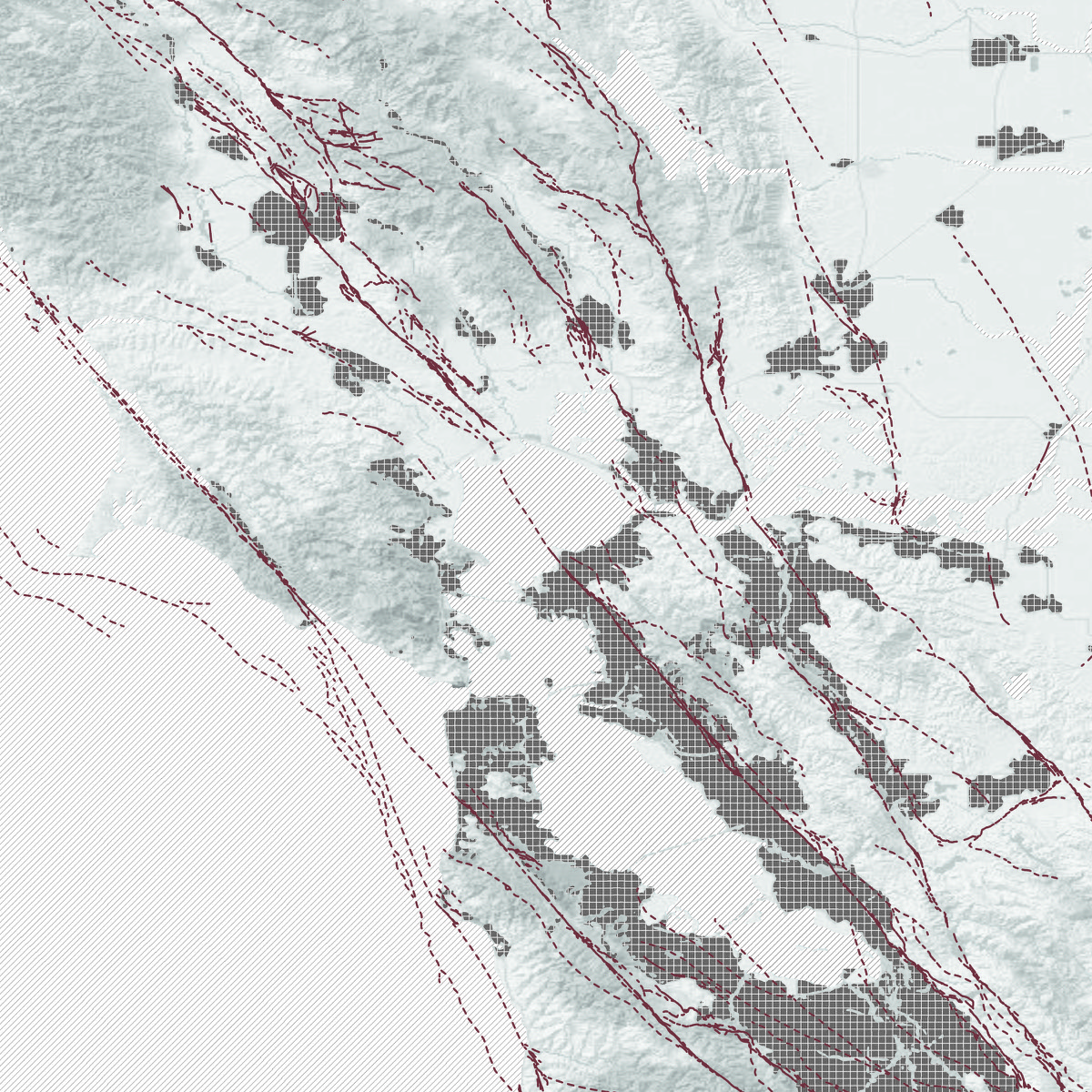
Earthquakes. The Bay Area is bracketed by two major faults, the San Andreas and the Hayward–Rodgers Creek. The USGS puts the chance of a magnitude 7 or larger earthquake in Northern California within 30 years at 76%. The 1989 Loma Prieta earthquake, a magnitude 6.9, cost billions; after the 1994 Northridge earthquake insurers raised prices or stopped offering coverage, and today about 90% of California homeowners have no earthquake insurance.
In 1906 the Bay Area's 650,000 residents lived through a magnitude 7.8 earthquake and the fires that followed; 225,000 were left homeless. Today nearly 8 million people live here. A major earthquake is inevitable, so there are two paths forward, taken at once: mitigation and recovery.
Site: Sonoma and Santa Rosa
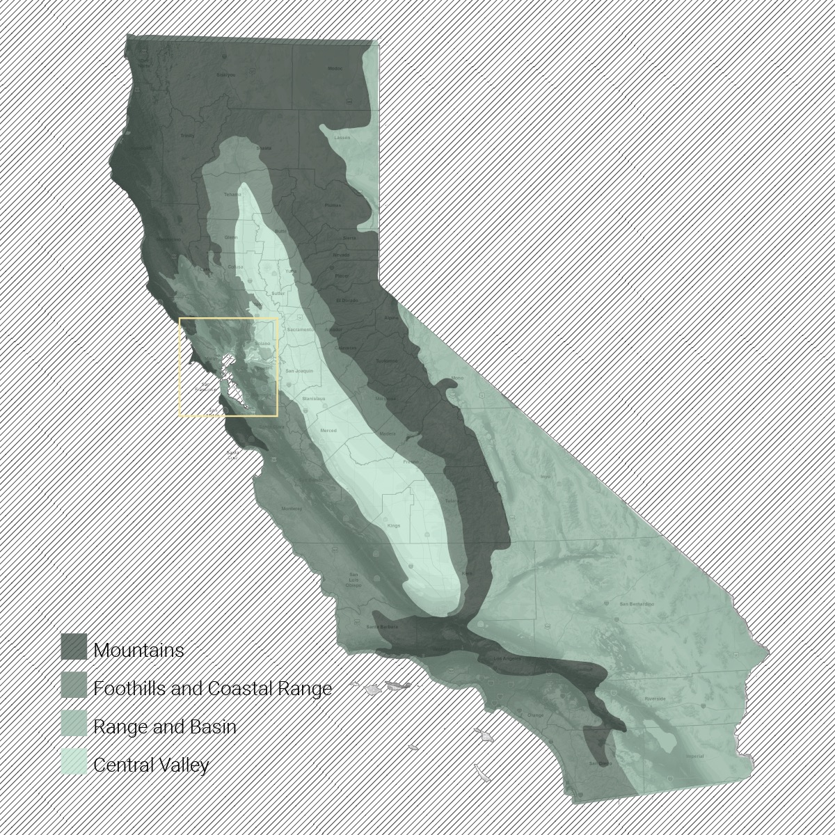
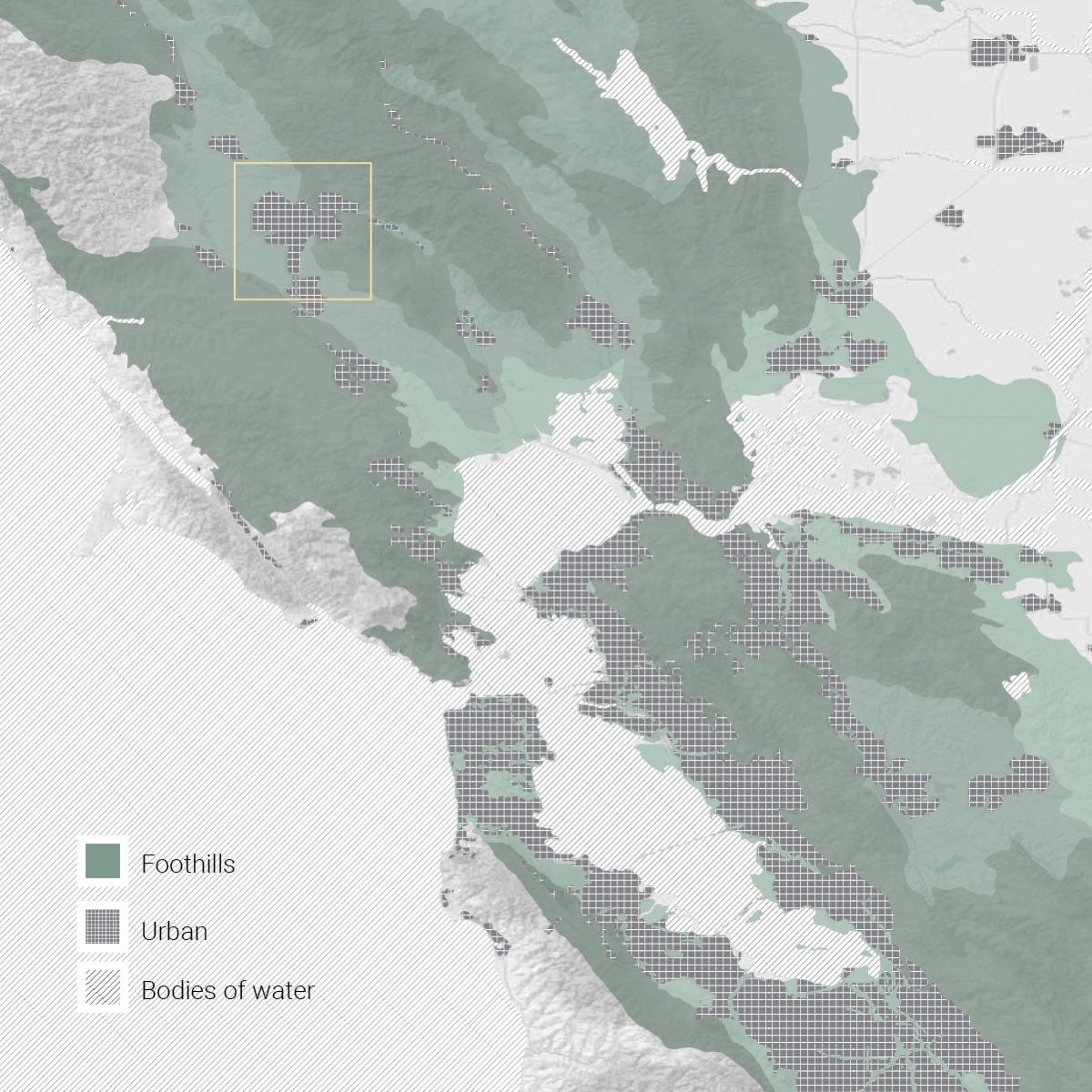
Sonoma. The Bay Area's northernmost county sits in the California foothills: low mountains, irregular plains and narrow valleys of chaparral, oak woodland and grassland. The valleys hold Wine Country, with more than 350 wineries in Sonoma Valley alone. Hot, dry summers that run into late autumn turn the vegetation into fuel, and the seasonal Diablo winds drive it. In 2019 almost the entire county was evacuated as the Kincade Fire spread.
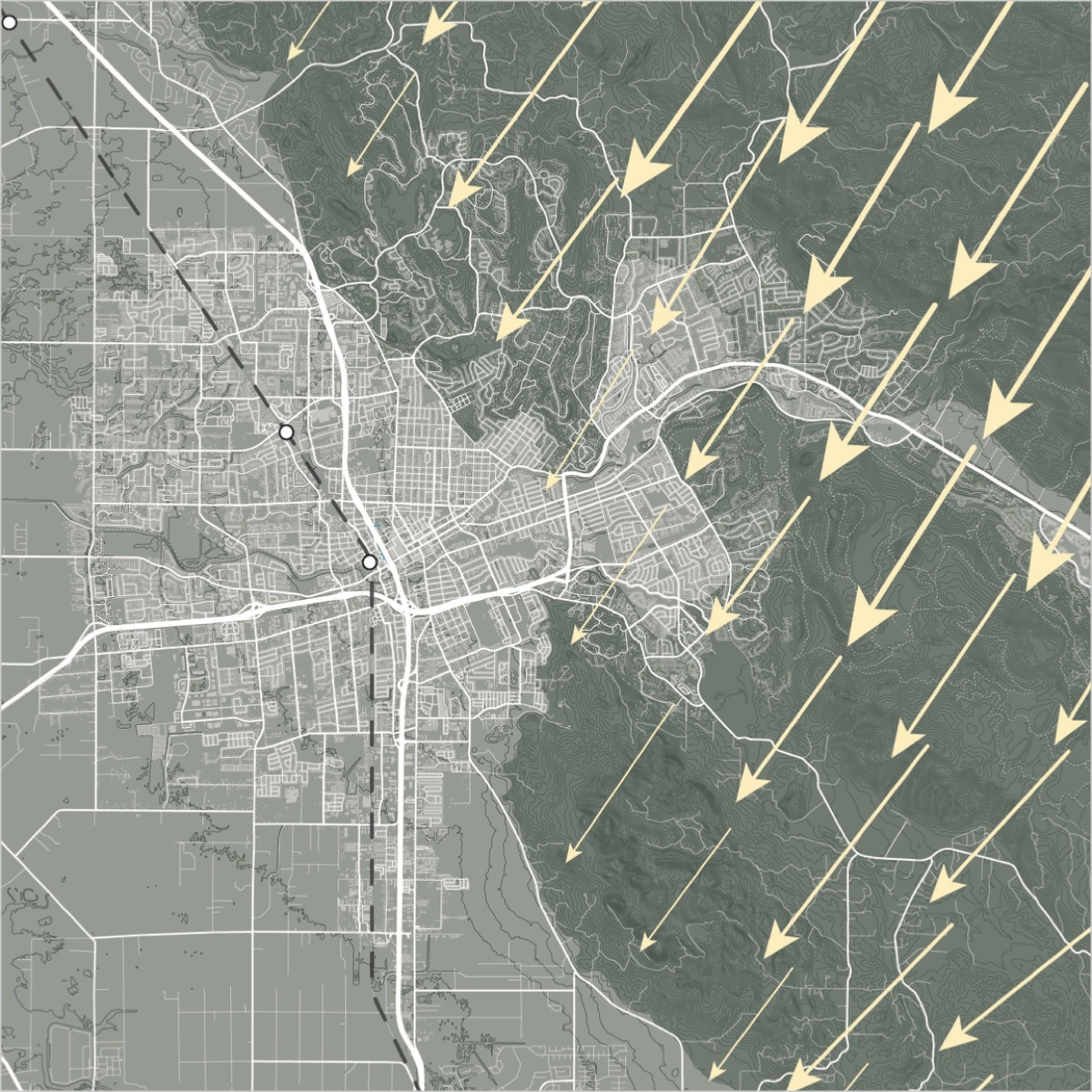
The Diablo winds in October 2017, driving the Tubbs Fire down from the hills into Santa Rosa.
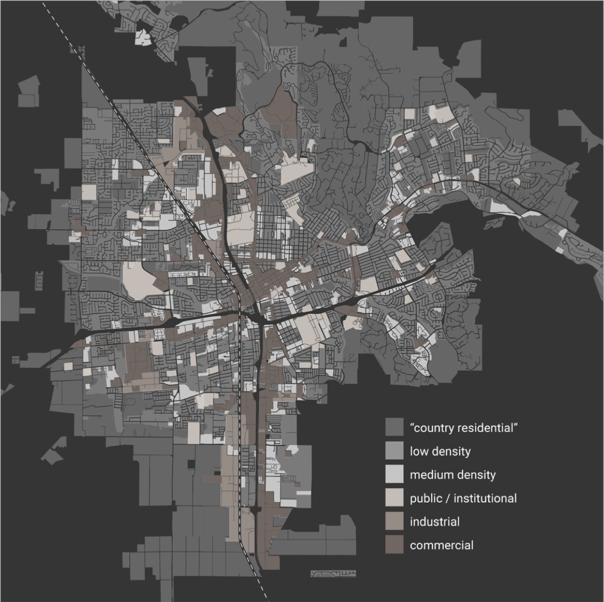
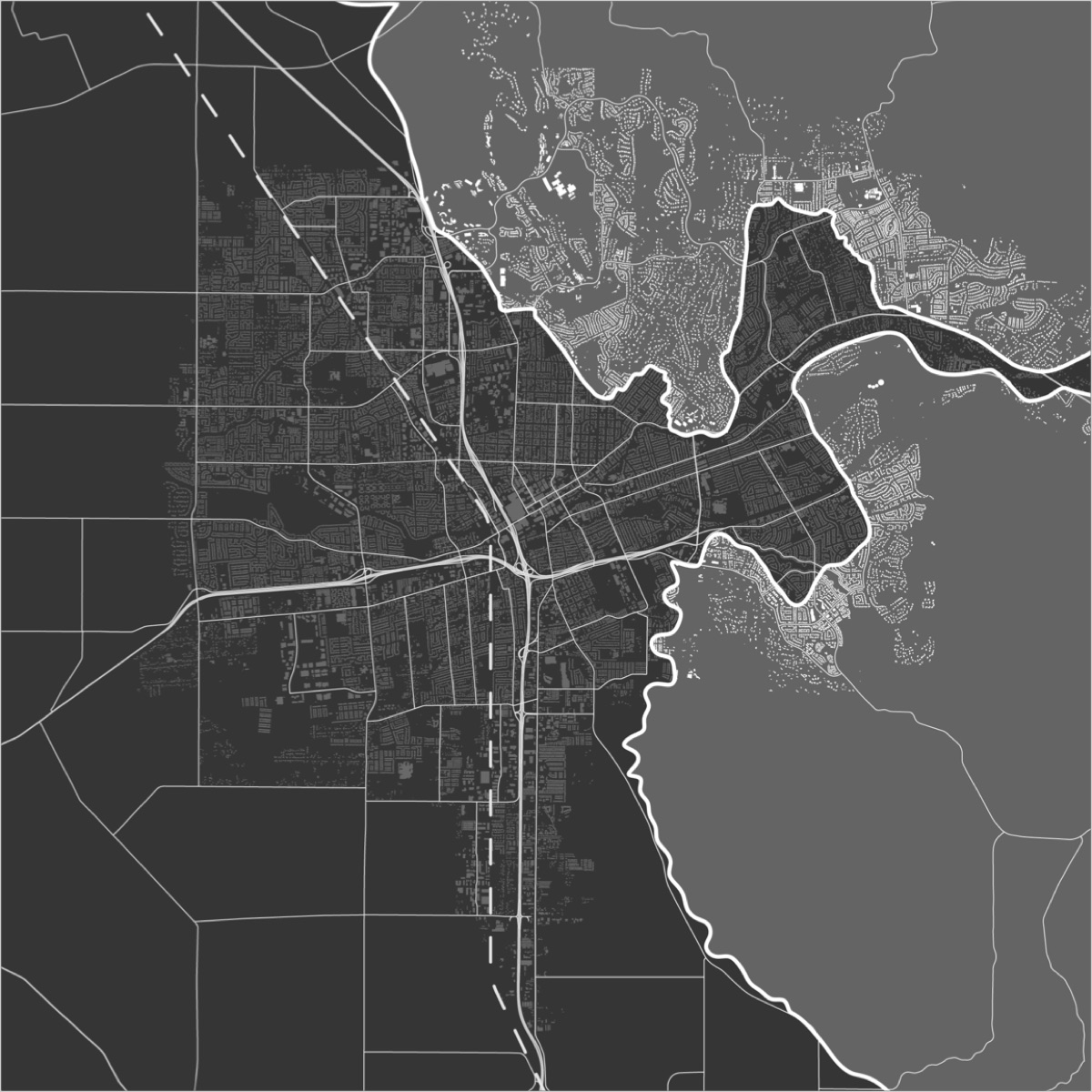
Santa Rosa. Sonoma's largest city lies along Highway 101 and the SMART line, where the valley meets the highlands: farmland to the west, wildland foothills to the east. For more than 50 years the city has annexed farmland and the wildland-urban interface for low-density housing, mostly after 1990. In 2017 it lost 5% of its housing stock to the Tubbs Fire, and more than 9,000 structures still sit in the fire-risk zone.
Strategy: retreat and cluster
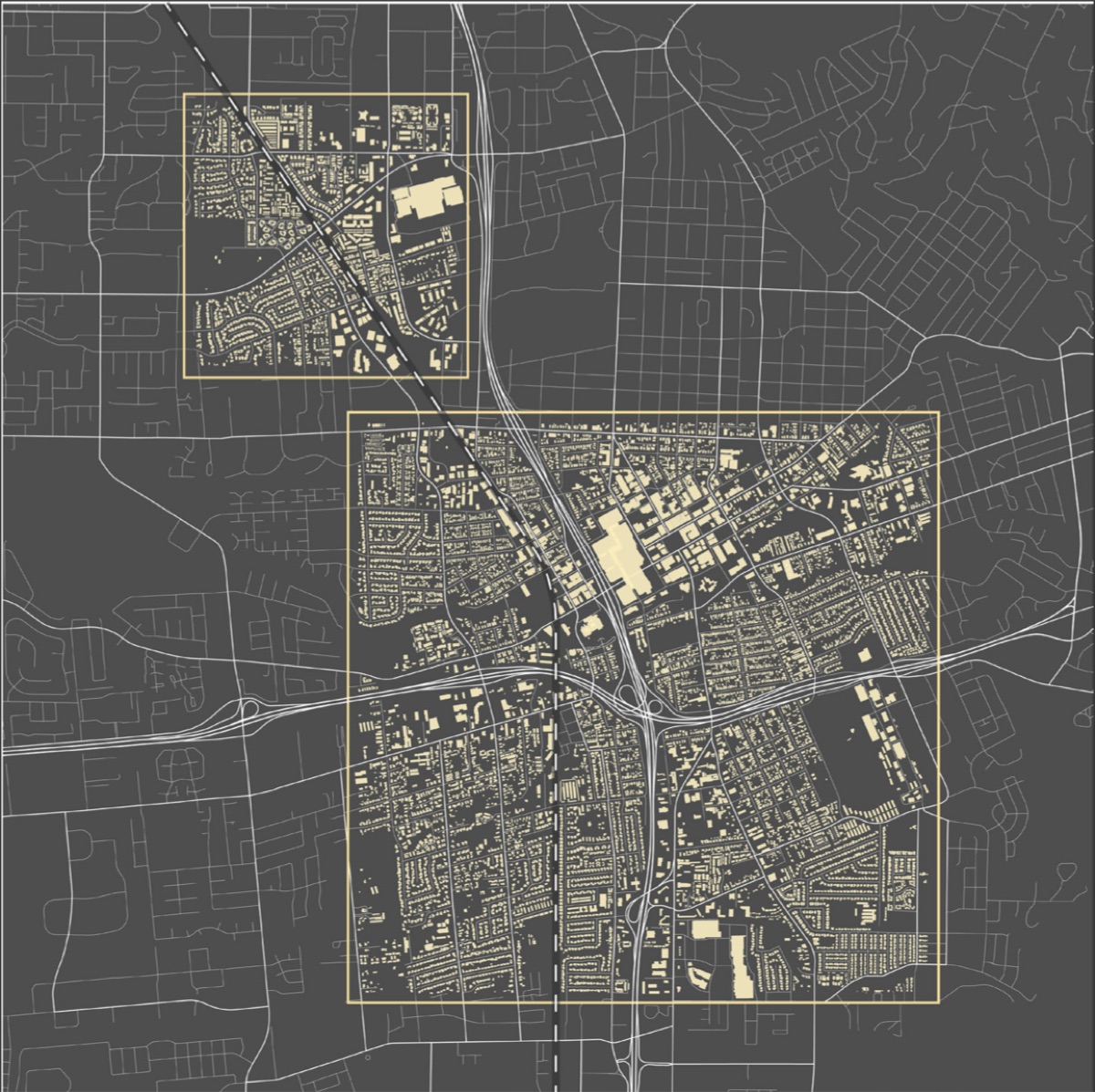
Fewer homes means fewer power lines, which means fewer wildfires.
Santa Rosa has upward of 9,000 homes in the wildland-urban interface, almost all of them single-family houses. Facing ever larger fires, the only viable answer is to retreat from the interface entirely. That reduces both the losses when fire comes and the chance of a fire starting in the first place.
Clustering is retreat's counterpart: the displaced homes are relocated within a fixed urban footprint, at higher density, gaining the social, economic and ecological benefits of shared amenities and economies of scale. The two cluster zones (right) sit on the rail line. Removal and relocation of the 9,000 homes is phased over 30 years, at a pace that also absorbs projected population growth.
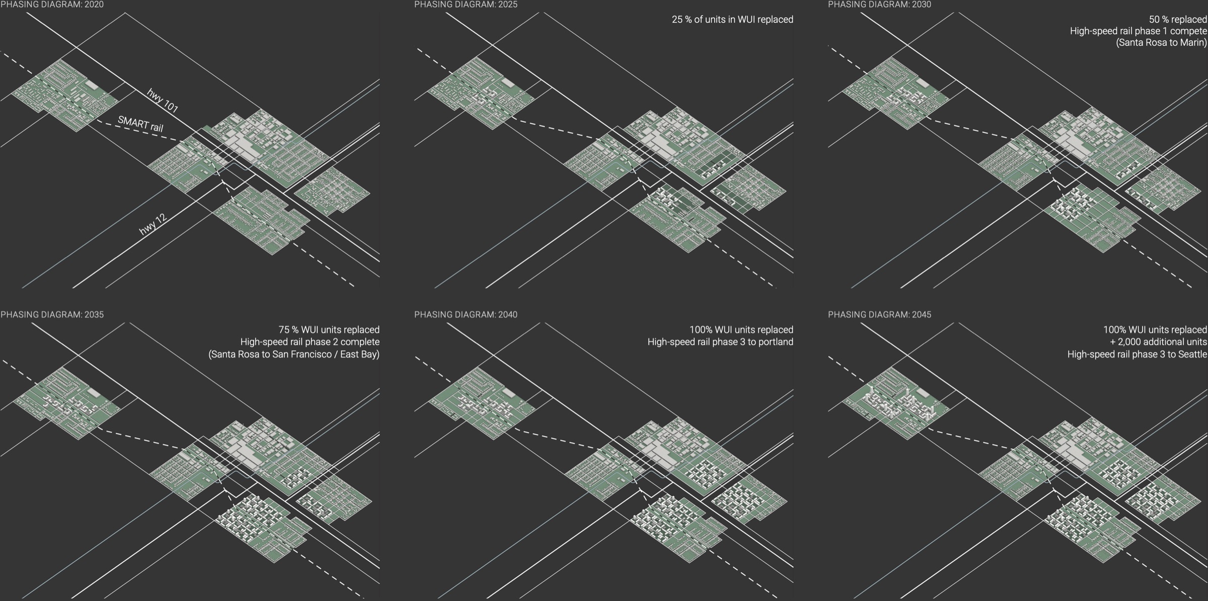
Phasing, 2020–2045. A quarter of the interface homes are replaced by 2025 and half by 2030, as a high-speed line opens to Marin. By 2035 three-quarters are replaced and the line reaches San Francisco and the East Bay. By 2045 every interface home has been replaced, plus 2,000 more, and the line runs on to Portland and Seattle. The high-speed rail is the thesis's own proposition, not a planned route.
Search Space
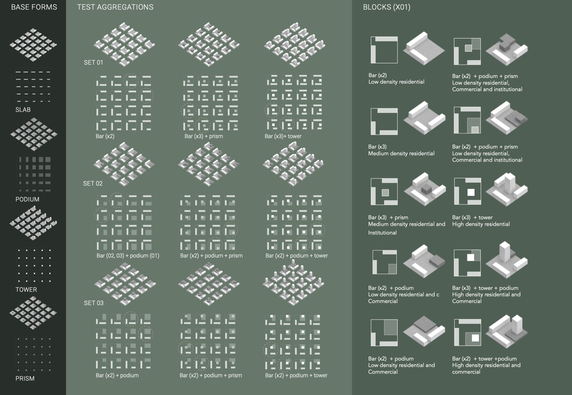
The Search Space is a recursive, form-finding process driven by two sets of rules. Internal, abstract rules are explicitly geometric: they generate matrices of orthogonal forms varying in height, length and width. External rules then select and refine those matrices against the urban context: its programmatic, economic, political and ecological conditions. Variation, selection and aggregation produce a set of forms that work as guidelines or zoning codes for the design phases that follow.
The process moves from the general to the particular, with selections continually evaluated, tested and revised. The outcome is not a fixed, ideal composition, but a system that can adapt to a range of possible futures.
Garden City
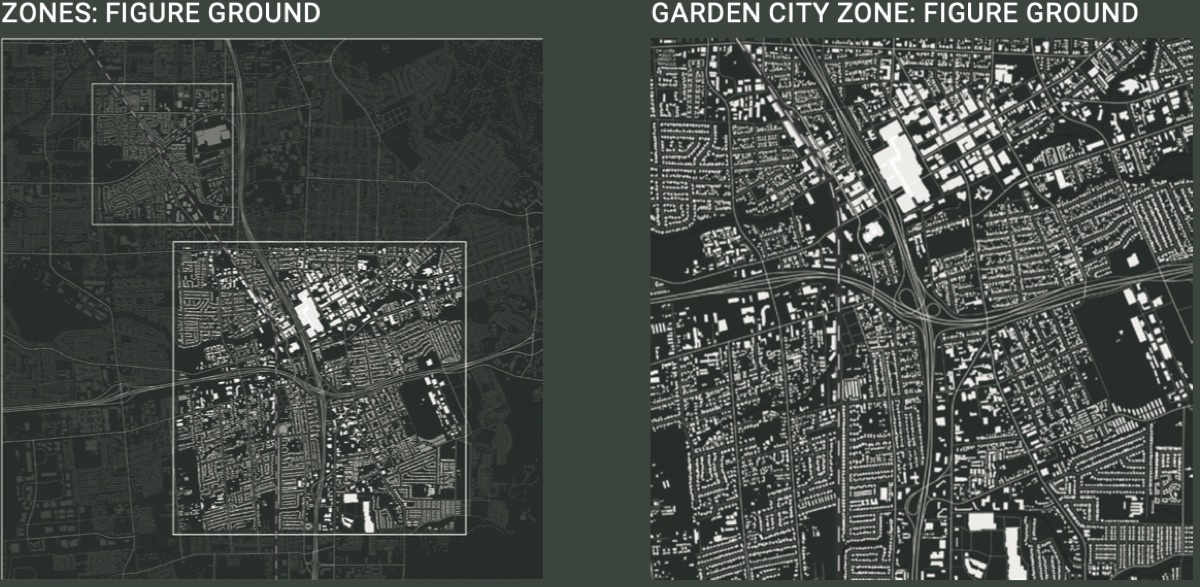
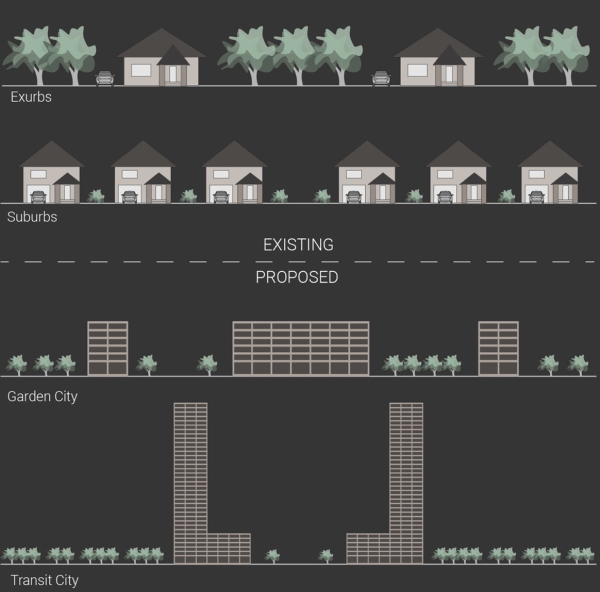
The first of the two cluster types. Garden City replaces detached houses with low- and medium-rise blocks set in open ground: the middle step in the move from exurbs and suburbs to Transit City.
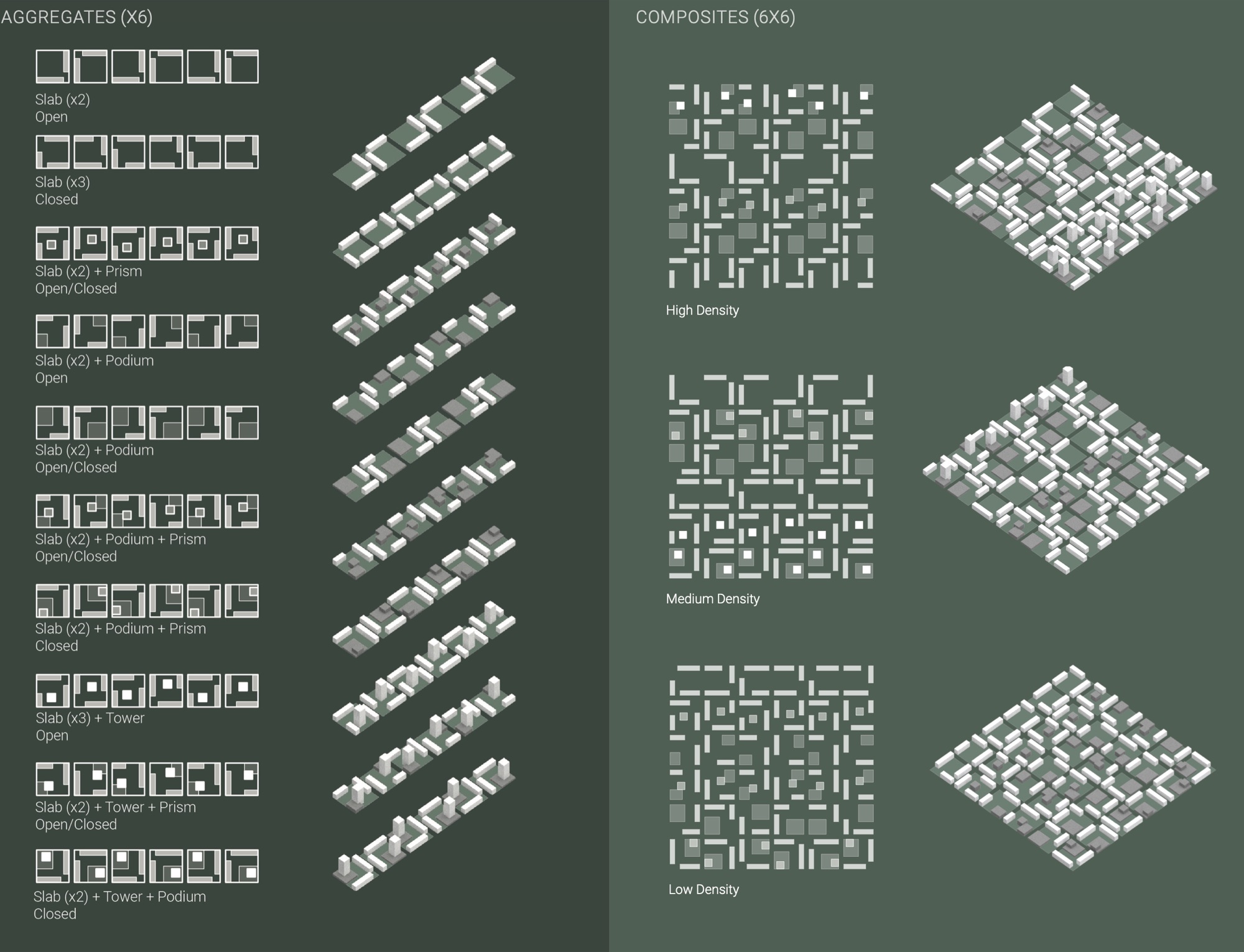
Its blocks come from the Search Space: pairs and triples of slabs, alone or with a podium, a prism or a tower, in open or closed arrangements. These are aggregated into lines of six, and the lines into six-by-six composites at low, medium and high density.
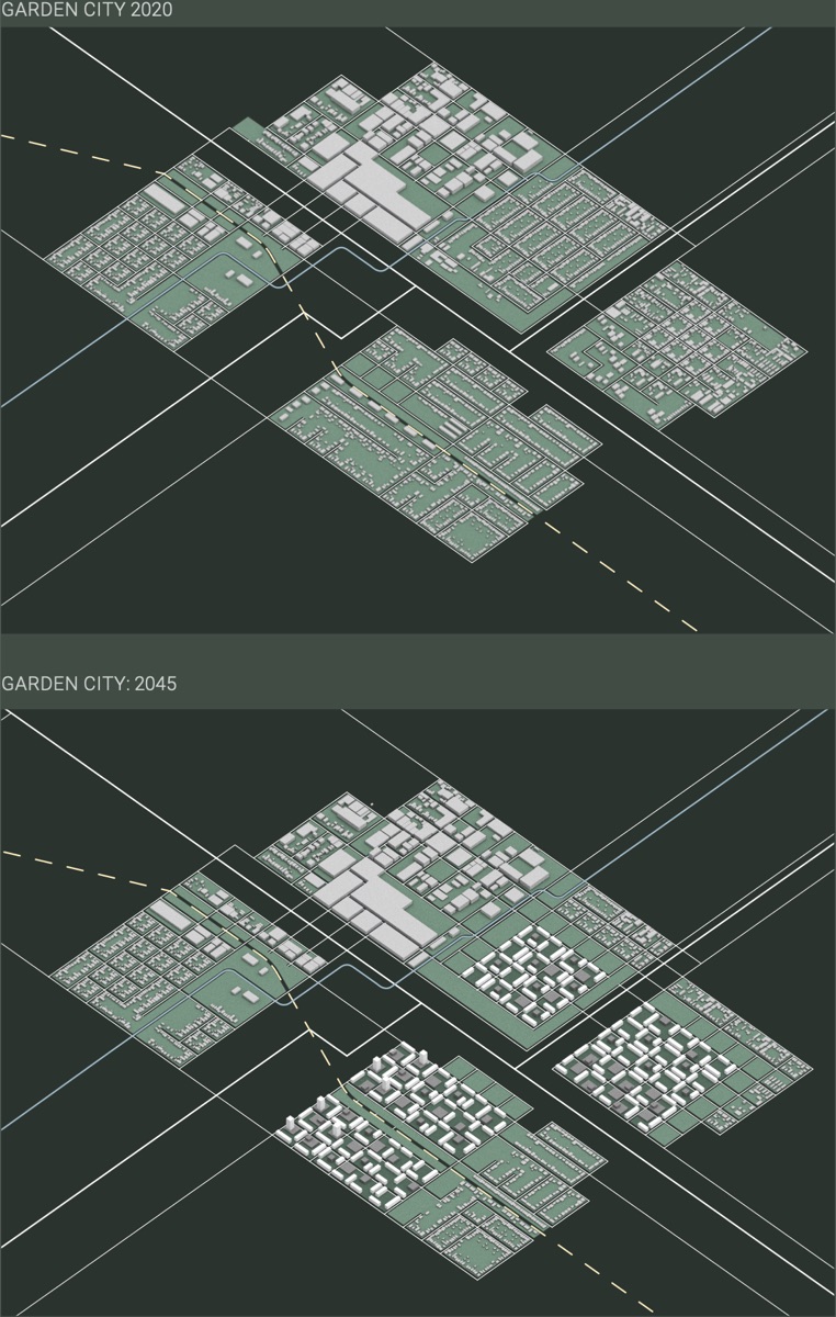
Garden City in 2020 and 2045: the composites gradually fill the cluster zones as the interface homes are retired.
Transit City
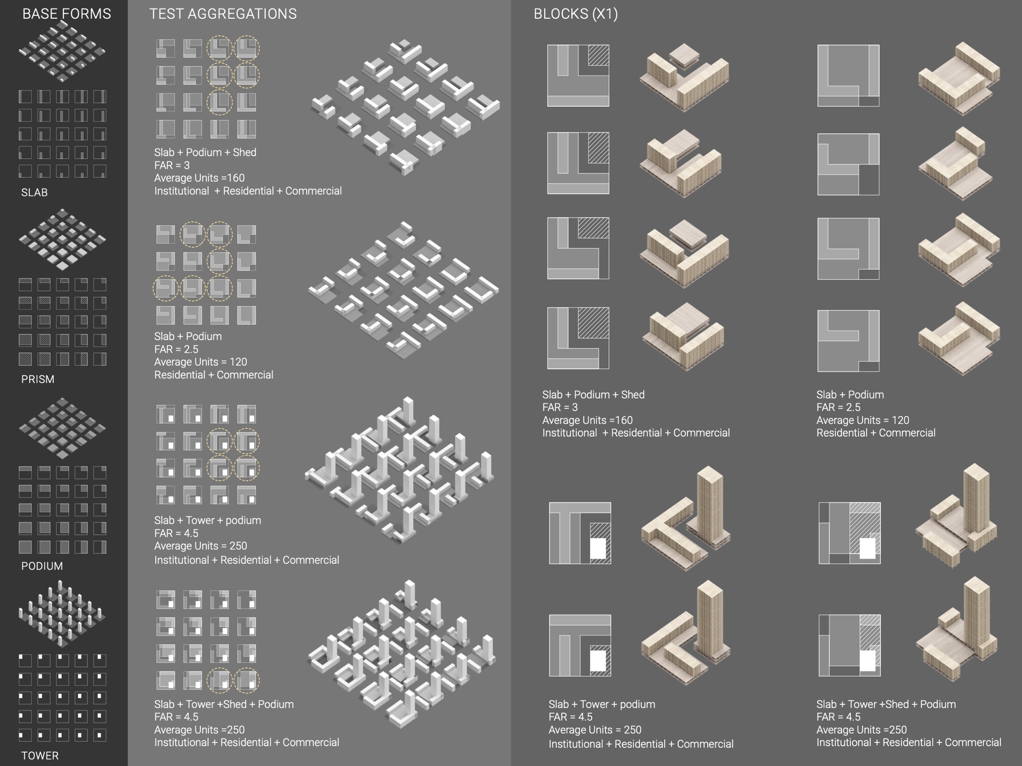
Transit City connects to local and regional centers by high-speed rail. It replaces low-density enclaves with high-density blocks built from four base forms: slabs, sheds, podiums and towers. Slabs and towers are residential, podiums commercial, and sheds public and institutional. Each block houses 120 to 250 homes, at floor-area ratios of 2.5 to 4.5.
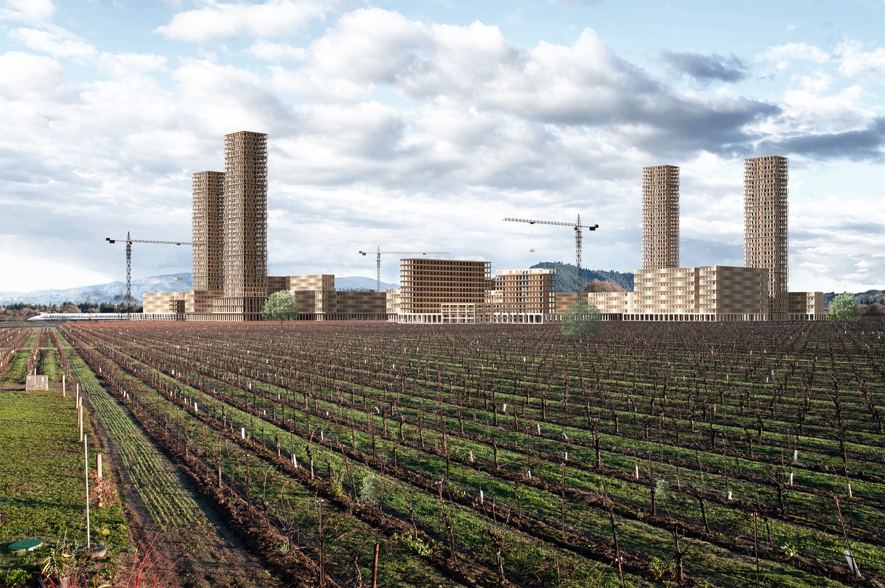
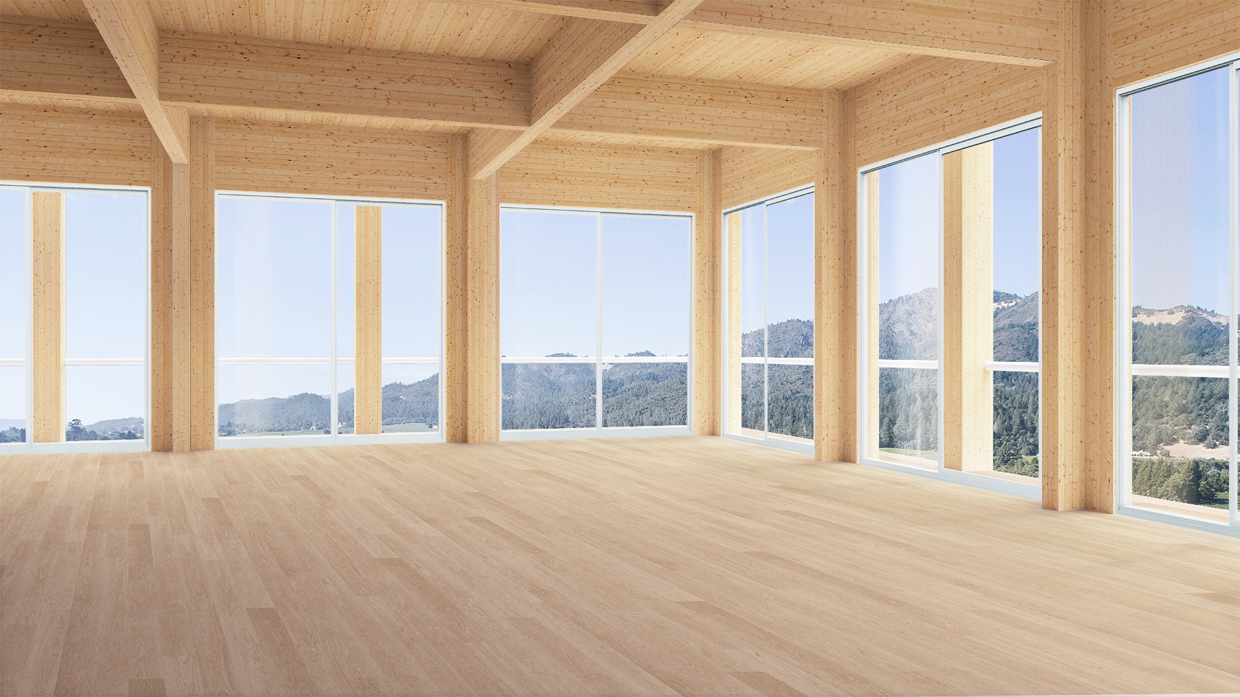
The towers, at 40 stories, are a radical departure from the existing residential type. They open unobstructed views to the surrounding landscape while shrinking the city's ecological footprint. The sheds form a network of social infrastructure, and the podiums hold commercial space and energy storage for solar power.
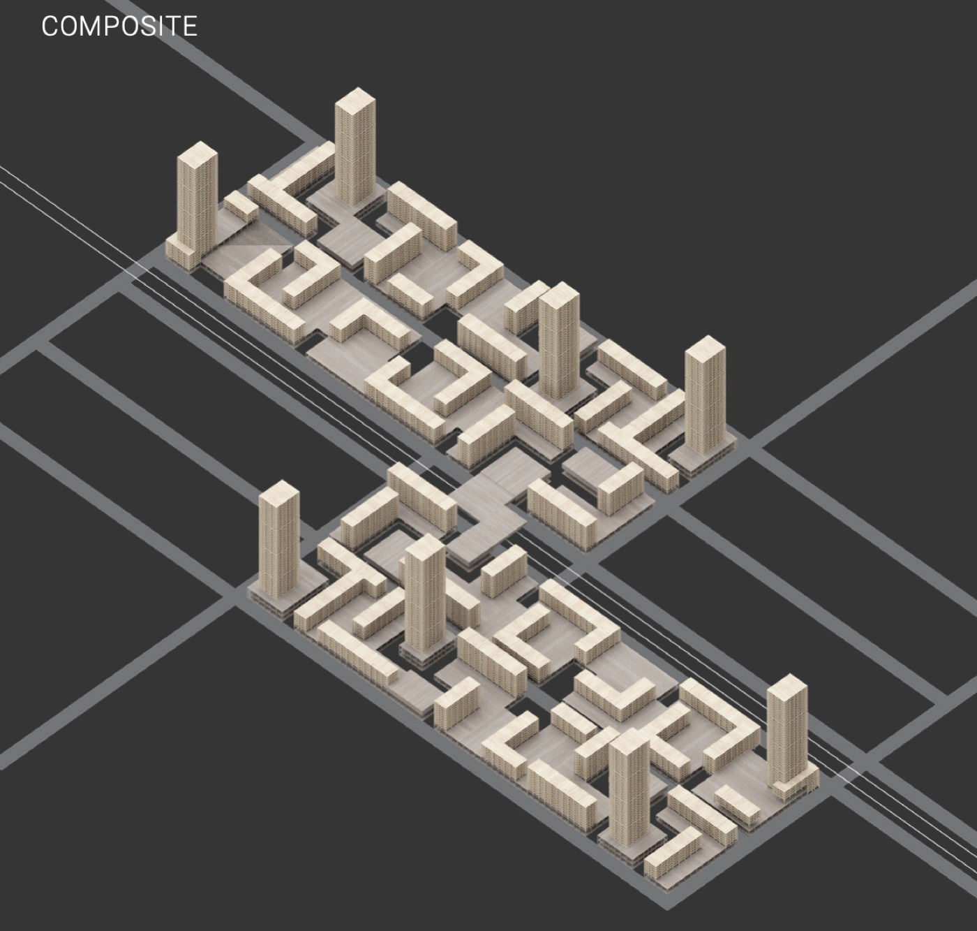
Blocks are either open, relating positively to their neighbors, or autonomous, merging at the podium level. They are aggregated into strips and composites laid along the rail line.
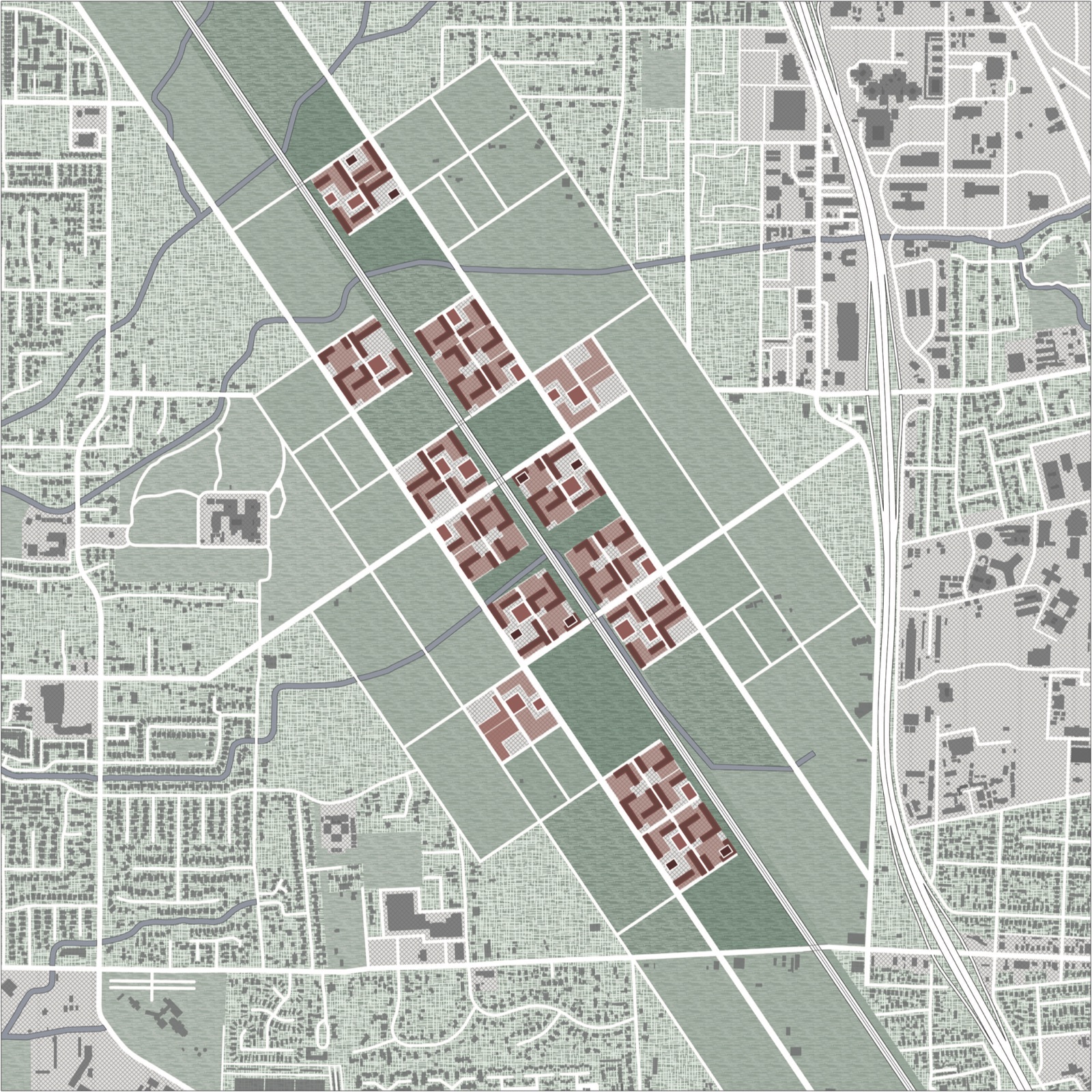
Phase 1 (2020–2030). Building begins in two underused industrial and commercial zones northwest and southeast of the North Santa Rosa SMART station. The first podiums and sheds provide public and commercial space for the towers and slabs that follow.
Phase 2 (2030–2040). The station becomes a high-speed commuter stop. New housing is built faster than land is cleared, absorbing homes displaced from both the station area and the fire zone, and the freed residential land returns to farming and community use.
As density concentrates along the rail line, the land at the edge of the development is planted with vineyards. They serve the local economy and form a firebreak around the whole development; the landscape closer in is adapted for recreation and everyday use.
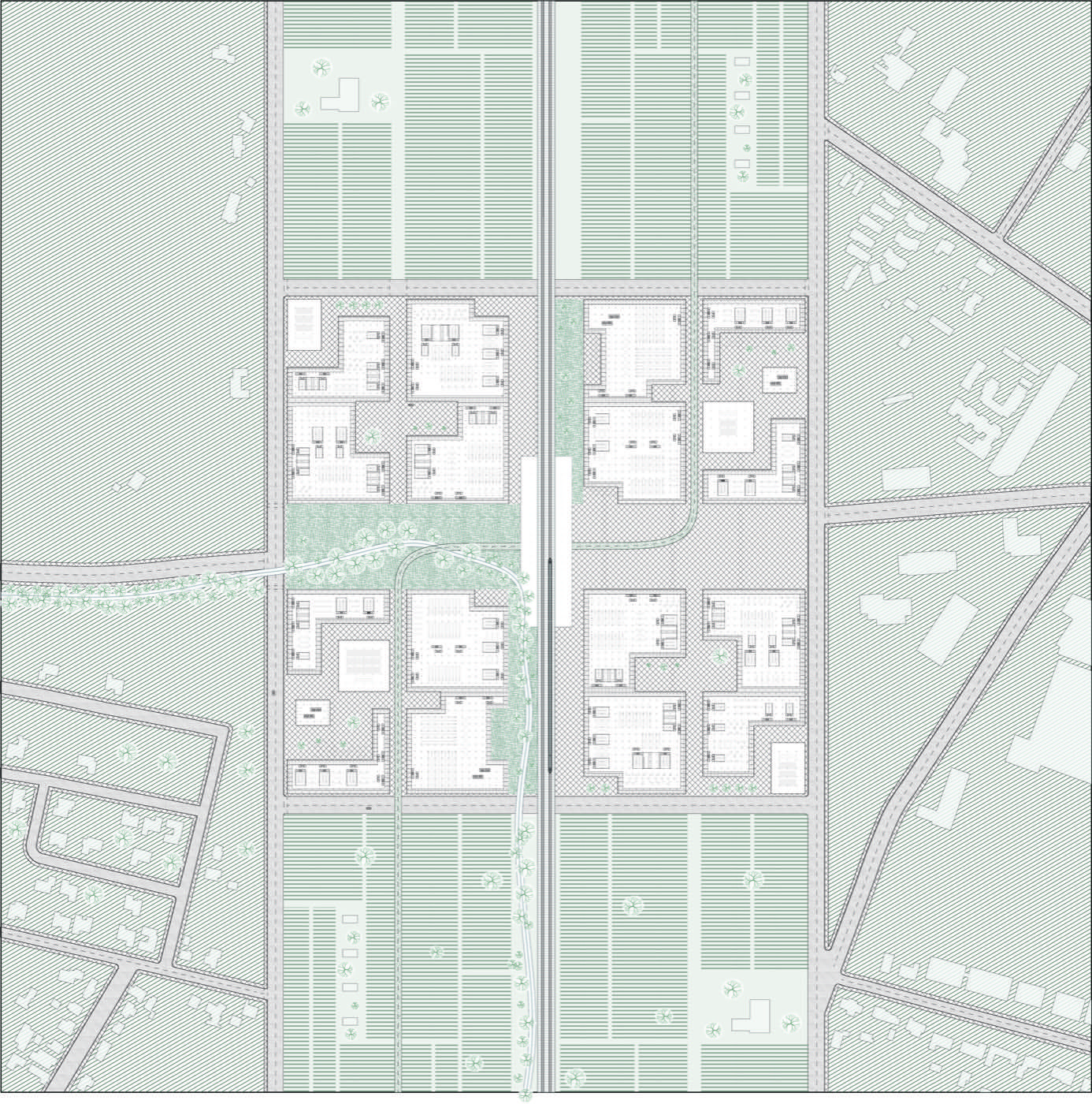
Ground plan, 2035: the station and its first blocks.
Seismic CLT
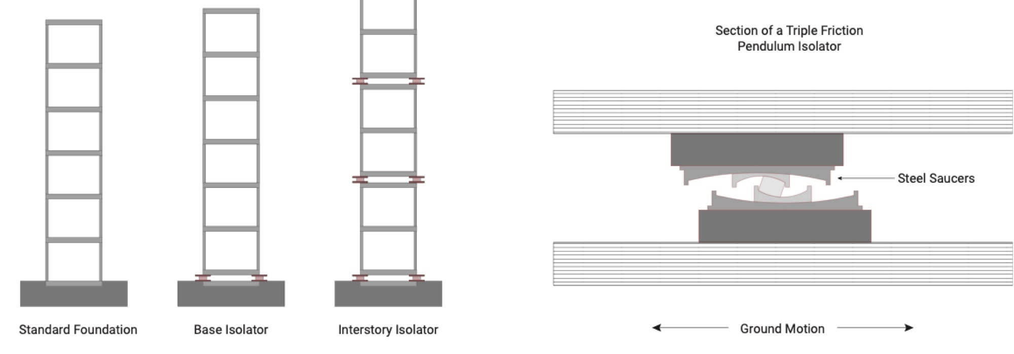
Cities are growing fastest in seismic regions, which makes sustainable, affordable building systems with strong seismic performance essential. Cross-laminated timber (CLT) is increasingly used for tall buildings: it is robust and performs well in fire, but the usual CLT shear-wall system is vulnerable at its connections in a strong earthquake.
One solution is inter-story isolation: isolators placed between floors, not only at the base, which shift lateral displacement and add damping. As of 2020 the approach had been used in steel and concrete buildings but not in wood. CLT makes tall wood buildings possible that can take full advantage of it.
Conclusion
For half a century, a reluctance to go beyond what is known and manageable has left a deficit of designs that meet 21st-century problems. Now we face more than we know and more than we can manage. The coming decades will need an urbanism that ties top-down strategy to bottom-up tactics.
Architecture can challenge the way we live and the patterns we inhabit, and by engaging the uncertainty of late modernity it can offer a glimpse of the society to come. This project aims to spark a dialogue, articulate a method and make an alternative reality visible. By bringing formerly unreasonable ideas into the open, we can leave our current state of organized irresponsibility and begin to imagine life after the apocalypse.
"A comprehensive Utopia may be out of reach, but the effort to realize it shapes the world for the better all the same."
Since then
Written in 2020. A few things have happened since:
The fires kept coming. In January 2025 the Eaton and Palisades fires in Los Angeles became the second and third most destructive in California's history, together destroying more than 16,000 structures.
The power lines. CAL FIRE found that the 2019 Kincade Fire was started by a PG&E transmission line.
Rebuilding in place. Santa Rosa's Coffey Park, leveled by the Tubbs Fire, was almost entirely rebuilt as it was within three years.
The plan. Santa Rosa adopted its General Plan 2050 in June 2025.
The rail. SMART reached Windsor in 2025, with Healdsburg expected by the end of 2028. It still doesn't connect to BART or Caltrain, and no high-speed line to the North Bay is planned.
Wood and earthquakes. Seismic isolation for tall mass-timber buildings is still mostly in the research stage; a full-scale shake-table test of a 10-story mass-timber building was published in 2024.